Torrey's Peak
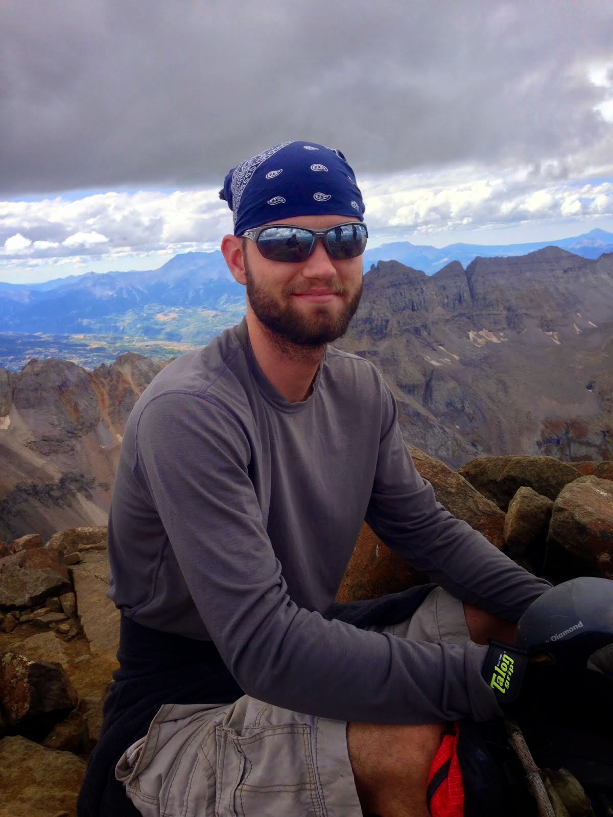
Date Climbed: 7/3/15
Climbing Partner: James
Elevation: 14,267
For more photos, follow me on Instagram or add me on Facebook:
drweiss2
Daniel Weiss
For almost a year now, Torrey's Peak has alluded my attempts to summit it. Once due to unpreparedness and inexperience, and twice because of deep snow. Out of all the 14ers, Torrey's Peak has captured my imagination the longest, mostly because my second 14er was Gray's Peak. When I first hiked Gray's, I felt a sense of awe at the sheer size, steepness, and ruggedness of Torrey's. Although the standard trail is nothing overly difficult, the one time I did summit Gray's, the saddle was covered in snow, and my inexperience led me to believe that it was like that year round.
A year later, with multiple 14ers under my belt and a number of winter ascents, I know that a little snow on the saddle is nothing to worry about. But there was one route up Torrey's that was famed for it's danger and technicality. Known as Dead Dog Couloir, this route is a class three (compared with the class one route up Grays) in difficulty, but is infamous for its avalanche and rockfall hazard. Just a few weeks before, a friend of mine had witnessed an avalanche come down the route. In fact, a man had died in 2011 from an avalanche on this route. Although I would not compare this to any of the Himalayan, Andes, or Alaskan peaks, it is a demanding route with quite a bit of danger. And for this reason, I knew it would be a challenge.
One of my favorite things about 14ers are the amazing views you receive as you slowly make progress up to the peak. This would prove to be no exception. However, the main draw of this route was its challenge. It would require speed, endurance, and technical knowledge. It would probably be the most difficult route I'd taken so far, and that thrilled me.
But for such a demanding route, I would need an experienced partner whom I could trust with my life in case of an emergency. My partner also needed to be self-reliant as I would be too busy trying to take care of myself to coach someone up this mountain. That is where James comes in. James is a pastor at a church in Lakewood, with a love for both God and mountaineering, much like myself. He also had some good experience on other technical routes and we had attended church together for a number of years until recently.
We arrived at the trailhead at 9 PM in the midst of the 4th of July traffic. Unfortunately, the trailhead was not spared from the crowd; we arrived to an almost full parking lot, and tents everywhere. Thankfully, we did find a spot and were able to set up our tents without too much searching. By the time I had brewed my hot chocolate and we had set up camp, it was approaching 10 PM. The plan was to depart at 3 AM and be on the couloir by 4 AM. On most days, the latest one wants to be on a steep climb like this is 7 AM, otherwise the sunrise warms the snow and the risk of avalanche and rockfall increases greatly. By my estimates, we would be topping out by 6 AM, an hour before the cutoff. I set the alarm and fell fast asleep.
"Hey Daniel." Came James' voice. "What?" I replied in a groggy voice. "It's 3:30." I was immediately wide awake and jumped out of my sleeping bag. How had I missed my alarm? I took my phone out of my pocket to make sure it had gone off. It had, but the sleeping bag had muffled the noise, and I was so exhausted from the hike up Bierstadt the morning before that I had slept right through it. Thankfully, we had only lost an hour, and still had a chance to make it.
We were on the trail by 4. I was able to move extremely well considering how tired I had felt the day before from my last climb. Moreover, I felt nothing from the altitude, since I had been up in the mountains so much this month. My body was well acclimatized. I only wish I had eaten and drank some water before I left, as I could feel the slight gnawing at my stomach from hunger.
Unfortunately, James had not had the luxury of acclimatization like I had. His job had kept him very busy the past few months, along with his recent marriage. This meant we could not make the couloir in 45 minutes as I had hoped. Instead, we reached the base of the couloir around 5:20. We would not get on the snow until 5:50, more than an hour and a half behind schedule, and right at sunrise. It would be a race to the top before the snow became too soft to support us. This slow pace also meant that we would take even longer to climb the route. No matter, we'd come this far, and the snow had a solid freeze the night before.
We strapped our crampons on, put on our harnesses and helmets for safety, and began our movement up the couloir. At first, progress was slow as the snow was fairly soft and shallow. We had to navigate some boulders in order to reach the steep bit of the couloir. Once we were on the ascent and the slope began to steepen, my progress sped up. In just 30 minutes, we had completed almost one-third of the couloir!
Suddenly, a loud scream and shouting came from across the valley. We both stopped and looked to see what was going on. Along the standard route up Gray's, almost directly opposite us, we could see a large group had stopped and there was quite a commotion going on. We looked at each other and tried to listen to what was going on. It appeared that some woman was screaming another person's name, but it wasn't obvious what was happening. At first I thought someone had fallen off the cliff on the opposite side that was around that location, just as Salix had almost done after chasing a mountain goat. However, as some other groups began to pass them and continue on, and as the group began to descend, we decided that it must have just been an argument. The shouting continued as the group moved down, and now others from within the group were yelling too, but this time it was obvious that hey were yelling at each other. From what I could gather, the group was arguing about whether or not to continue up, and had ultimately decided to turn around. It did ruin the tranquility of the valley a bit, but at least we were sure no one was seriously hurt.
We continued on our way, and I began to see why there was so much talk about the rockfall on this route. Boulders the size of my chest and bigger littered the snow, and many had fallen recently, their paths clearly marked in the snow. If one even the size of my fist were to hit us, we could be in danger of falling down the couloir (a fatal slide) or even in danger of internal trauma damage. Rescue from this kind of spot would not be easy either, and without cell reception, it would be a long time until help arrived. Just a few days later, another climber was air lifted from Snowmass with internal bleeding from a rock that had hit him in the chest.
Airing on the side of caution, I decided to cross over to the left side of the couloir, even though it meant a steeper climb, softer snow, and crossing a five foot deep rut (an awkward movement on such a steep slope). The rut took me about 5 minutes to cross, which is quite a bit of time for such a short distance. I also had to climb up some rock once I had crossed the rut, which was very difficult in crampons. In all I had gained only a few feet and had wasted a lot of time and energy. The momentum I had built up had been lost and now I began to feel as though I was running on empty.
Just as frustration began to take its grip, I looked over my shoulder and saw Stephen's Gulch laid before me, bathed in the early morning sun, with just the shadows of the mountains protecting the bottom of the valley. It was a beautiful sight, and my frustration vanished as I soaked it in. I took a large gulp of water and continued my climb. I was just below the halfway point now, and we were about an hour in. On schedule in terms of our speed, but far behind with how soft the snow would be on top.
James was a ways below me, struggling with the altitude. I decided I would be able to help him better if I worked on kicking in some good steps and creating a clear path. I also knew that if I could get to where I could see the couloir exit, it would give him a boost of energy. So I began the hard work of front pointing straight up the slope. For those who are unfamiliar with snow climbing, front-pointing is also called the German technique. It is where a climber kicks the front two points of their crampons into the snow in order to get the points to bite. It allows a climber to ascend very steep routes more quickly, and also climb routes that are too steep for other techniques. The drawback is that it is hard work as it forces the climber to go straight up the slope as opposed to switchbacks., and it is a lot of work on the calf muscle.
With this technique I made great time and was almost two-thirds of the way up the couloir in a matter of 15 minutes. I Stopped and looked back over the view. I could just make out the ant line of people starting their hike up Gray's Peak. It would be a busy day, but maybe a few of them would catch some pictures of us! I turned and could see that I would have to make a choice: aim right or left at the fork. Since I had not studied that route as much as I should have, I did not know the proper way. I only knew that one would lead to extremely steep and unsafe terrain and the other would lead to the exit. I yelled back down to James asking his opinion. He said that we needed to turn left, otherwise we would end up on the knife edge along the Kelso Ridge, another classic route. I disagreed though. That morning on our approach, we had seen three other climbers heading up Dead Dog. As we watched the other climbers' headlamps make progress up the couloir, it appeared that two of them went left and began to slow down. This, we assumed, was the dangerous terrain. Yet now James and I were at the same spot and could not decide which way would be the safest. I followed my gut and went right, kicking in steps and navigating a narrow part of the couloir. James was still at least 30 minutes behind me, and I knew that we might be facing a dangerous exit with the soft snow.
By this point, the sun had already been burning at the snow at the top for an hour and a half. I had to top out quickly in order to beat the snow, and hopefully be in position to set up a safe belay for James should he need it. I raced to the top, front-pointing every step in order to make progress. Just as I began to take the right fork, the snow became softer and softer. Soon, my crampons required to kicks in order to bite into solid snow, otherwise they simply slid down the soft snow and I was forced to use my ice axe to stop myself from sliding down. I looked up and could see other climbers as the passed over the knife edge. Every once in a while they would offer words of encouragement and told me I was on the right track. I bowed my head down and pushed through the last few hundred feet to the finish. The top was soft and steep, but it made a great finish to a climb. The ridge I ended up on was no more than 4 feet wide, so I sat on the edge of the couloir to allow the Kelso Ridge climbers to pass, beaming with pride. I had just completed a very dangerous and classic route up Torrey's Peak, a summit which had eluded me for almost a year. I still had just about 200 feet to go, but that would be a simple walk to the finish, and I wanted to complete it with James next to me.
I pulled off my backpack and got my rope ready and checked my harness, ready to provide James with a belay if it started to get too dangerous. After about 20 minutes with no sign of James, I began to worry that something had happened. Just as I began to think I might have to down climb the couloir, I saw his head pop around the corner of the rock. I yelled down to him, encouraging him on and telling him that I was at on the exit so he didn't have far to go. He fist pumped the air and started toward me in earnest.
With just the last 20 feet to go, he told me to take a picture for his wife and then searched for a safe way up. The snow was now very soft and I asked if he wanted a belay. He told me he was ok, and he slogged through the last bit to the finish. It was an impressive feat to do such a climb without any real exercise or preparation, and I couldn't believe he was able to finish it. It was a very long climb, with about 1500 feet of elevation gain. We had done it, and now all we had was a walk to the finish.
Clumsily, we stumbled through snow, ice, and dirt to the finish, telling others that we would not take off our crampons until we summited because they "looked cool," and I wanted a picture on the summit in them. After a few pictures, some food, and laughs, we took in the scene on top and then hiked back down the standard route. Every once in a while people would ask if we were the ones who had climbed Dead Dog, and they asked about the snow and climb and what it had been like. It was pretty cool to achieve something like that and have witnesses. The hike back was long and uneventful, and by the end we were ready to get home.
With Dead Dog under my belt, I was ready for more challenges. I knew I had the technical ability to summit the famed Long's Peak in the winter, and I knew I had the ability to get through the snow on the Grand Teton. It was just a matter of dealing with the technical rock climbing now. And for that, it was time to start preparing for the Elk mountains and the Crestones, both of which would require class 4 and up rock climbing. The adventures thus far had tested my nerves and some of my technical skills. But now I was entering into the true mountaineering world and there were greater adventures that lied ahead. I could only pray that I was up to the task and that God would guide me through it.
Daniel

Mt. Sneffles
Showing posts with label Front Range. Show all posts
Tuesday, July 7, 2015
Tuesday, April 7, 2015
Mt. Evans
Mt. Evans
Date Climbed: 4/6/15
Climbing Partners: Solo
Range: Front
Elevation: 14,264
As usual, the road up to Guanella Pass was closed about a mile and a half from the trailhead for Bierstadt. Having been up the road many times on similar hikes, I knew it would take me about an hour to reach the trailhead and then it would be a tough slog of postholing to the base of Mt. Spalding (A 13er just northwest of Mt. Evans). It was a quiet morning, crisp and cool. Although the forecast had projected 55 mph gusts, I didn't even hear so much as a breath of wind in the trees. The snow was firm and hard packed on the road from countless hikers and skiers. It was so hard, in fact, that I almost wished I had brought my four wheeler to try and cut some time from my hike. I knew that as the day warmed up, however, that I might had to wait until dark to get back down on it as the snow softened up.
I made very good time up the road. I felt stronger and in better shape than I had in a while, especially at this altitude (I image in part because of the basketball league I had joined). I took a shortcut up some steep snow and managed to make it to timberline in about 40 minutes. Instead of taking the road all the way to the trailhead, I decided to take a shortcut that I had heard about a few months earlier, leaving the road at the second to last switchback and going straight for Spalding. Apparently a few other hikers had the same idea as I was able to follow their footprints for a good distance. Surprisingly, the snow supported me very well, and only had one or two minor postholes on the way to the base of the mountain. Because of this, it took me only twenty minutes to get to my intended destination.
Just a few months before, in February, I had done the same trek, although I had gone all the way to the Bierstadt trailhead and through the dreaded willows up Gomer Creek. Back then, it took me an entire hour and a half to reach the same point. Even with snowshoes, the endeavor left me worn out and by the time I had reached this point, I had to turn around because of time and energy. I decided that I would need to backpack in if I wanted to get Evans in when there was snow.
I decided to give it another go this time without backpacking in. As the snow had frozen rather well, I figured there wouldn't be powdery snow as there had been in February, and I was right. Stopping at the base of the mountain, I observed the next stage of my climb. I had two choices: I could hike up the dry part of spalding, meaning it would basically be a summer hike (which is much quicker) but it also meant traveling a good distance out of my way. My second option was to take the steep gully right next to the Sawtooth. On my drive up, I was favoring the latter, but once I saw how long of a climb it would be, mixed with the uncertain avalanche conditions and lack of a second ice axe, I decided to take the hike.
I took of my snowshoes, packed them away, and began the hike up Spalding. Again, I made excellent time as there was little to no snow on my hike. Once in a while I would spot a cairn and breath a sigh of relief that I was on the right path. Every fourteener I had done so far this winter (this being my first winter doing this) had been an endless game of trail-breaking, route-finding, and avalanche avoidance. It was nice to see the familiar cairn guiding my way (I desperately miss summer. I love climbing in the snow, but I love the green and warmth of the summer). By 10:30, I had reached 13,700 feet (according to my watch). I had found some old ski trails that I had hoped would lead to Evans, and so I had followed them. I looked up and knew I was almost at the summit. However, as I looked at my surroundings, I began to realize I was too low to be on Evans. I had climbed too quickly and could see Bierstadt looming about a mile or two away. I was still too low to be approaching the summit of Evans.
By this point, the wind was starting to pick up, and I could tell it would turn nasty in the next half hour, so I quickly pulled out my map to try and figure out where I was so that I could get up and get out. As I observed the map, I began to have a sinking feeling in the pit of my stomach that I had mistakenly climbed Mt. Spalding instead of Evans. I was on the northwest slope of a mountain, but the question was which mountain? Slowly, I got uptick a few steps to my right (south) and a giant rugged and ugly peak began to come into view just over the side of the slope. I bowed my head in frustration, realizing I had wasted so much energy and time climbing the wrong mountain. I put away my map and started moving as quickly as I could toward Evans.
I would have to lose about 300 feet (which was the bad) and travel a mile or so to reach just the north summit of Evans. This may not sound bad, but when you get that close to what you think is the summit and then realize you've got a lot more work ahead of you, you'll know just how draining that can be emotionally and physically. My pace began to slow as I grew more tired and the snow grew softer. By the time I had reached the middle of the saddle between Evans and Spalding, the wind had gone from a nice breeze to a roar. The closer I got to the cliff on the saddle, the stronger the wind became. Slowly, I began to regain the elevation I had lost. I also began to see the cairns again, which gave me an energy boost, knowing that I could follow the summer trail.
By the time I had reached the last part of the saddle, the wind had become so fierce, that I had to take cover every few steps in order to regain my energy and warm myself up. Although I had been sweating in just my thermal just a few minutes before, it was now winter temperatures. I pulled out my heavyweight gloves, threw on my thermal and swapped my beanie for my windproof baclava (I had learned my lesson from climbing Democrat and the other mountains in that range). I packed down my backpack as best I could, set it next to a cairn and left it behind, intended to make a quick assault on the summit, praying that I would be okay without my shell jacket.
I was less than a quarter of a mile and 300 feet from the summit, and so thought I could make it in less than fifteen minutes. What I did not see, however, was the difficult and exposed section I would have to climb in order to reach the summit. I am still not sure if I had simply gone the wrong way or if it was just much more difficult than the others had made it sound, or if the winter conditions simply made it twice as difficult as I had thought it would be. Whatever the case, I quickly found myself inching my way up rocks that were smooth as ice, with no dexterity (because of my gloves and mountaineering boots) over a drop of about 3000 feet. This was easily the most technical climb I had ever done, and I was doing it in 50 mph winds and no footholds.
At some points I would be climbing up rock hard snow, shoving my ice axe in to protect me from a fatal fall, the next I would be taking leaps of faith, praying the rock I jumped up to would hold my weight and that my gloves would grip it. After 40 minutes of relentless climbing and route-finding. I finally gave up on finding and "easy" way up, and went directly up the face of the mountain. I made it to the summit very quickly, leaving behind my ice axe so as to have both hands free to climb the last bit. When I reached the top, I was greeted with an old and familiar sight: Colorado laid bare before me, with no peaks obstructing my view. I had reached the summit. I looked to my right and could see the south summit, looming even with me. I had a brief moment of disappointment, know that the south summit was considered the "true" summit by many (since that is the one most people climb up to after a nice drive up the paved road). I like to think that this was the mountaineers summit: requiring one to fight through snow and rocks over perilous drops in order to stand on the top.
I decided I would stand at the top of that summit one day after a nice drive up the road with some friends. I took some pictures and quickly retreated down to get out of the wind. After 30 minutes of careful descending, I finally made it to my backpack. I sat down, ate a CLIF bar for my lunch and some energy, and began my descent.
It was much slower than I expected. The snow was slick as it was wet with the warm sun, but still hard enough to support my weight, thus making it very easy for one to slip and slide down. I had to drive my ice axe deep into the snow to help balance myself. I also had another looming danger: avalanches. Although it was only April, the temperatures had been unseasonably warm, so the snow was melting fast, but there were still subtstantial amounts above timberline; enough to create large and dangerous avalanches. Although the route I had taken earlier was dry, the direct route back to the bottom of Spalding from Evans was still packed with waste deep snow; plenty to slide and bury someone. What's more, the snow was on just enough of an angle and showing just enough signs of instability for me to worry. This made for slow going, although I did finally make it back to the willows by 1 PM (a lot later than my hoped for 10:30 summit time).
I donned my snowshoes and began the dreaded hike across the now slushy snow. A hike that had taken me 20 minutes turned into a grueling 40 minutes. Although this wasn't the worst I had seen, every posthole was agony both to my feet and my energy. By this point I had already hiked 10 or 11 miles and was exhausted. I could only move at a snails pace, mindlessly putting one foot in front of the others, focusing on the nice smooth surface the road would provide for my aching feet. I had seen no one else the whole day, which was odd as I had seen at least one other person on every summit I had attempted, even in the dead of winter. This too, wore on me, as I did enjoy knowing there was help nearby in case of emergency. From the looks of it, no one else had made it even close to Spalding the entire day. I was truly alone.
I finally reached the road, and quickly descended through the mercifully supportive snow. I had one last obstacle left: the 1/4 mile avalanche zone along the road, and then I would be home free. I was apprehensive as the avalanche website had warned us to be on the lookout for loose wet avalanches in the afternoons near treelike, especially on east facing slopes (which was exactly where I was at). I quickly moved through the zone without incident and made it back to the car by 3. I gratefully sat down in the drivers seat and felt a flood of relief and excitement. I had conquered my twelfth fourteener and my first one of 2015 and had two more fourteener planned in the next 2 weeks. I was finally ready for life at 14,000 feet again.
Date Climbed: 4/6/15
Climbing Partners: Solo
Range: Front
Elevation: 14,264
For more photos, follow me on Instagram or add me on Facebook:
drweiss2
Daniel Weiss
"Would you be mad if I climbed a fourteener tomorrow?" I asked. My wife and I were sitting on the couch watching TV this particular Sunday night. We had developed a system by now: I would beg to go on a fourteener, she would be reluctant, I would buy her dinner or something, and she would relent. I think she was just happy to have the next day off from work, so she said "Yes." By this point, it was 10:30 at night, and I knew I would have to get up very early the next day. I got up and began to pull my equipment together and she went to bed. I checked in on 14ers.com to check the conditions of Mount Evans. Warm temperatures and high winds; worth a shot.
When I say warm temperatures, I mean a balmy 20 degrees in the morning, although it was projected to get into the mid 30s by the afternoon. However, having been on a fourteener with high winds and cold temperatures, I knew better than to underdress. A thermal bas layer, a down jacket and hard shell pants and jacket, along with crampons, ice axe, and snowshoes to deal with the snow and ice. I was packed and ready by 12:30. I finally showered and went to bed, setting my alarm for 4:50 AM.
It only felt like an hour or two when my phone woke me up. I layed there for about five minutes, trying to come up with some excuse not to go today; to just sit at home and sleep in. However, my desire to get in a fourteener after such a long wait was overpowering. I got up, pulled on all of my clothes and gear and left the house by 5:25. I was at the trailhead by 6:50 and on my way up shortly thereafter.As usual, the road up to Guanella Pass was closed about a mile and a half from the trailhead for Bierstadt. Having been up the road many times on similar hikes, I knew it would take me about an hour to reach the trailhead and then it would be a tough slog of postholing to the base of Mt. Spalding (A 13er just northwest of Mt. Evans). It was a quiet morning, crisp and cool. Although the forecast had projected 55 mph gusts, I didn't even hear so much as a breath of wind in the trees. The snow was firm and hard packed on the road from countless hikers and skiers. It was so hard, in fact, that I almost wished I had brought my four wheeler to try and cut some time from my hike. I knew that as the day warmed up, however, that I might had to wait until dark to get back down on it as the snow softened up.
I made very good time up the road. I felt stronger and in better shape than I had in a while, especially at this altitude (I image in part because of the basketball league I had joined). I took a shortcut up some steep snow and managed to make it to timberline in about 40 minutes. Instead of taking the road all the way to the trailhead, I decided to take a shortcut that I had heard about a few months earlier, leaving the road at the second to last switchback and going straight for Spalding. Apparently a few other hikers had the same idea as I was able to follow their footprints for a good distance. Surprisingly, the snow supported me very well, and only had one or two minor postholes on the way to the base of the mountain. Because of this, it took me only twenty minutes to get to my intended destination.
Just a few months before, in February, I had done the same trek, although I had gone all the way to the Bierstadt trailhead and through the dreaded willows up Gomer Creek. Back then, it took me an entire hour and a half to reach the same point. Even with snowshoes, the endeavor left me worn out and by the time I had reached this point, I had to turn around because of time and energy. I decided that I would need to backpack in if I wanted to get Evans in when there was snow.
I decided to give it another go this time without backpacking in. As the snow had frozen rather well, I figured there wouldn't be powdery snow as there had been in February, and I was right. Stopping at the base of the mountain, I observed the next stage of my climb. I had two choices: I could hike up the dry part of spalding, meaning it would basically be a summer hike (which is much quicker) but it also meant traveling a good distance out of my way. My second option was to take the steep gully right next to the Sawtooth. On my drive up, I was favoring the latter, but once I saw how long of a climb it would be, mixed with the uncertain avalanche conditions and lack of a second ice axe, I decided to take the hike.
I took of my snowshoes, packed them away, and began the hike up Spalding. Again, I made excellent time as there was little to no snow on my hike. Once in a while I would spot a cairn and breath a sigh of relief that I was on the right path. Every fourteener I had done so far this winter (this being my first winter doing this) had been an endless game of trail-breaking, route-finding, and avalanche avoidance. It was nice to see the familiar cairn guiding my way (I desperately miss summer. I love climbing in the snow, but I love the green and warmth of the summer). By 10:30, I had reached 13,700 feet (according to my watch). I had found some old ski trails that I had hoped would lead to Evans, and so I had followed them. I looked up and knew I was almost at the summit. However, as I looked at my surroundings, I began to realize I was too low to be on Evans. I had climbed too quickly and could see Bierstadt looming about a mile or two away. I was still too low to be approaching the summit of Evans.
By this point, the wind was starting to pick up, and I could tell it would turn nasty in the next half hour, so I quickly pulled out my map to try and figure out where I was so that I could get up and get out. As I observed the map, I began to have a sinking feeling in the pit of my stomach that I had mistakenly climbed Mt. Spalding instead of Evans. I was on the northwest slope of a mountain, but the question was which mountain? Slowly, I got uptick a few steps to my right (south) and a giant rugged and ugly peak began to come into view just over the side of the slope. I bowed my head in frustration, realizing I had wasted so much energy and time climbing the wrong mountain. I put away my map and started moving as quickly as I could toward Evans.
I would have to lose about 300 feet (which was the bad) and travel a mile or so to reach just the north summit of Evans. This may not sound bad, but when you get that close to what you think is the summit and then realize you've got a lot more work ahead of you, you'll know just how draining that can be emotionally and physically. My pace began to slow as I grew more tired and the snow grew softer. By the time I had reached the middle of the saddle between Evans and Spalding, the wind had gone from a nice breeze to a roar. The closer I got to the cliff on the saddle, the stronger the wind became. Slowly, I began to regain the elevation I had lost. I also began to see the cairns again, which gave me an energy boost, knowing that I could follow the summer trail.
By the time I had reached the last part of the saddle, the wind had become so fierce, that I had to take cover every few steps in order to regain my energy and warm myself up. Although I had been sweating in just my thermal just a few minutes before, it was now winter temperatures. I pulled out my heavyweight gloves, threw on my thermal and swapped my beanie for my windproof baclava (I had learned my lesson from climbing Democrat and the other mountains in that range). I packed down my backpack as best I could, set it next to a cairn and left it behind, intended to make a quick assault on the summit, praying that I would be okay without my shell jacket.
I was less than a quarter of a mile and 300 feet from the summit, and so thought I could make it in less than fifteen minutes. What I did not see, however, was the difficult and exposed section I would have to climb in order to reach the summit. I am still not sure if I had simply gone the wrong way or if it was just much more difficult than the others had made it sound, or if the winter conditions simply made it twice as difficult as I had thought it would be. Whatever the case, I quickly found myself inching my way up rocks that were smooth as ice, with no dexterity (because of my gloves and mountaineering boots) over a drop of about 3000 feet. This was easily the most technical climb I had ever done, and I was doing it in 50 mph winds and no footholds.
At some points I would be climbing up rock hard snow, shoving my ice axe in to protect me from a fatal fall, the next I would be taking leaps of faith, praying the rock I jumped up to would hold my weight and that my gloves would grip it. After 40 minutes of relentless climbing and route-finding. I finally gave up on finding and "easy" way up, and went directly up the face of the mountain. I made it to the summit very quickly, leaving behind my ice axe so as to have both hands free to climb the last bit. When I reached the top, I was greeted with an old and familiar sight: Colorado laid bare before me, with no peaks obstructing my view. I had reached the summit. I looked to my right and could see the south summit, looming even with me. I had a brief moment of disappointment, know that the south summit was considered the "true" summit by many (since that is the one most people climb up to after a nice drive up the paved road). I like to think that this was the mountaineers summit: requiring one to fight through snow and rocks over perilous drops in order to stand on the top.
I decided I would stand at the top of that summit one day after a nice drive up the road with some friends. I took some pictures and quickly retreated down to get out of the wind. After 30 minutes of careful descending, I finally made it to my backpack. I sat down, ate a CLIF bar for my lunch and some energy, and began my descent.
It was much slower than I expected. The snow was slick as it was wet with the warm sun, but still hard enough to support my weight, thus making it very easy for one to slip and slide down. I had to drive my ice axe deep into the snow to help balance myself. I also had another looming danger: avalanches. Although it was only April, the temperatures had been unseasonably warm, so the snow was melting fast, but there were still subtstantial amounts above timberline; enough to create large and dangerous avalanches. Although the route I had taken earlier was dry, the direct route back to the bottom of Spalding from Evans was still packed with waste deep snow; plenty to slide and bury someone. What's more, the snow was on just enough of an angle and showing just enough signs of instability for me to worry. This made for slow going, although I did finally make it back to the willows by 1 PM (a lot later than my hoped for 10:30 summit time).
I donned my snowshoes and began the dreaded hike across the now slushy snow. A hike that had taken me 20 minutes turned into a grueling 40 minutes. Although this wasn't the worst I had seen, every posthole was agony both to my feet and my energy. By this point I had already hiked 10 or 11 miles and was exhausted. I could only move at a snails pace, mindlessly putting one foot in front of the others, focusing on the nice smooth surface the road would provide for my aching feet. I had seen no one else the whole day, which was odd as I had seen at least one other person on every summit I had attempted, even in the dead of winter. This too, wore on me, as I did enjoy knowing there was help nearby in case of emergency. From the looks of it, no one else had made it even close to Spalding the entire day. I was truly alone.
I finally reached the road, and quickly descended through the mercifully supportive snow. I had one last obstacle left: the 1/4 mile avalanche zone along the road, and then I would be home free. I was apprehensive as the avalanche website had warned us to be on the lookout for loose wet avalanches in the afternoons near treelike, especially on east facing slopes (which was exactly where I was at). I quickly moved through the zone without incident and made it back to the car by 3. I gratefully sat down in the drivers seat and felt a flood of relief and excitement. I had conquered my twelfth fourteener and my first one of 2015 and had two more fourteener planned in the next 2 weeks. I was finally ready for life at 14,000 feet again.
Subscribe to:
Posts (Atom)