Daniel

Daniel
Mt. Sneffles
Showing posts with label fourteeners. Show all posts

Wednesday, February 24, 2016

Humboldt Peak

Humboldt Peak
Date Climbed: 2/19/16- 2/20/16
Climbing Partners: Matthew, Gabriele, and Anthony
Elevation: 14,064

For more photos, follow me on Instagram or add me on Facebook:
drweiss2
Daniel Weiss


     After a lot of preparation and some failed attempts on other peaks, I was ready for another try of Humboldt. I had previously visited the peak last winter and turned around due to avalanche conditions. This time I had planned to avoid the avalanche terrain and take the East Ridge route, the most common route up Humboldt in winter. But I needed some help. A good friend of mine, Matthew, and I met at a coffee shop to discuss details on a February attempt. After discussing some details, we soon had a plan and a team. We would meet February 19 at 4 AM and carpool to Humboldt, where we would set up camp at timberline and summit the next day.
     There were two reasons for this: first, I knew it would be a long route, especially since we had no idea how well our team would work together. Second, The winds were predicted to be 70+ on the 19th. with an exposed ridge climb for an extended period of time on one of Colorado's windiest 14ers, our margin of error would be too small. So I deeply believed our greatest chance of success was to wait out the storm and make summit day as easy as possible. Plus, I just love winter camping.
     With this in mind the 19th quickly came and our team of four climbers met in the parking lot the church I work at in downtown Denver. It was Matthew and I, Anthony (a friend of Matthew's), and Gabriele (a CCU student I invited to join). So our ragtag bunch threw our backpacks into the back of my truck and drove off into the darkness. By 7 AM, we were at the lower trailhead of Humboldt and the winds were horrific. Just opening the door to the truck was a feat in itself! Nonetheless, we were in high spirits with the warm temperatures and an adventure ahead of us. It took us about half an hour to get all of our gear together, and off we went down the road. Our pace was extremely slow with the winds in our faces, but we eventually made it to the shelter of the trees and donned our snowshoes.
     Up we went, and quickly made it to the Rainbow trailhead, where our route would take us off the road and onto the East ridge. Even in the trees, he winds were uncomfortable and very loud. Even when we were feet from each other, we had to shout to hear. Slowly, the miles ticked by and we made progress up the ridge, occasionally getting glimpses of the lower east ridge above timberline. Even with a hard snow crust at higher elevations, plumes of snow could be seen on the mountain tops, which meant the winds must have been very strong to blow crusty snow. As we progressed, the slope angle became steeper and steeper, and soon we were stumbling through the now slushy snow up a very steep slope. Thankfully the avalanche danger was mitigated by the trees, and we safely passed our only worrying slope for the trip. Shortly after our steep slog, the trees began to thin and the wind became stronger and louder. Timberline was near, and soon we could see our ridge.
     Our team was exhausted, and camp sounded like a welcome idea, even though it was not quite noon. But since our team had not done many winter camping trips, I knew we would be slower in setting up camp, and so we got to work. After digging out a very large, three foot deep shelter for our tents, began to pull them out of our bags. Since no one else had a four season tent, I volunteered my three season tent as tribute for the other half of our party. Out came the tent, and immediately the wind attempted to take it. Thankfully, our shelter somewhat protected out tent from the wind, and after a bit of work the tent was up and anchored in (as best as we could with the slushy snow). The second tent, my four season one, went much faster and it was securely anchored to the snow in no time. After fiddling with some of the anchors to make sure the tents would not be blown away we all dived into our respective tents and began to unpack.
     First, off went the boots, then came the sleeping pad, the sleeping bag, the extra layers, and the kitchen. As we hunkered down and began to melt water, the sunlight durned from bright yellow, to orange, and the sun began to set. I left the tent door open so that the fumes would not build up in the tent and so that we could enjoy the awesome views of the mountains to our east. Although the winds were still unrelenting, the tent offered a comfortable shelter. Stars began to come out and our tent made dinner. After a satisfying meal of granola and stroganoff, we went to bed.
     As the night dragged on, the wind howled more, and more ferociously, and I could hear the other tent's rain cover flap louder and louder. It was as though a jet plane was right above us the whole night and I began to worry that a storm was brewing. I pulled out my phone and managed to get some service, and looked up the forecast. The winds would remain constant until noon the next day, but I read some news that 148 mph winds had been recorded not too far from where we were. If that reached us, it would be fatal, even with warmer temperatures. I sent up a silent prayer and went back to sleep.
     Early the next morning, we began to melt snow for our water and started discussing our plan. The winds had not gone away, but they were a little better than the day before. I just had to hope that the forecast would hold so that we could make it past the final ridge. Soon we had left camp and were moving at a quick pace. As soon as we had exited the trees, the wind howled at us. It seemed as though the mountain itself wanted to keep us away from the summit, pushing us back with all its might. We dropped the snowshoes and began our long walk along the wind blown rocks leading to the summit. The first major obstacle was a huge 1000 foot slope from where we would finally see the summit of Humboldt.
     Every step was an effort, and even with the sun and high temperatures (relatively speaking), the wind was bitter and icy. We eventually had to pull out heavier layers, and I even had to put on my heavy weight gloves. After an hour of hard work, our progress still seemed minuscule, and the wind would not relent. Thankfully, I could just see the summit around the corner of the slope. The last bit would be more technical than before, but if the winds did not let up soon, we would not be able to make it. As the summit inched closer and closer, I felt stronger and soon even the wind began to die down.
     Progress across the flat part of the ridge went quickly, and we only had about 500 feet of scrambling above us. Up we went, climbing over rocks and around boulders, avoiding the huge drop off to our right. The others made it a minute before I did, but soon, there was nothing but blue sky above me and I knew I was almost there. As I climbed over the last step, the others came into view, all smiles. We had made it! The dramatic view of the Crestones alone was worth the trip. Off to our right was Kit Carson and Challenger, and to the left we could just make out the infamous Little Bear Peak.
     After taking plenty of pictures and congratulating each other, we descended the ridge, going as fast as our tired legs would go. On the way down, we lost track of our snowshoes and had to traverse under a few worrying slopes until we finally reached them. We put them on and descended to our high camp. As soon as we were at our tents, Anthony flopped down on the snow next to his tent and I dove into mine, looking forward to a good lunch and some water. We took a quick rest and packed up our gear.
     It was early afternoon by now, and we still had several miles to cover. Down we went through the now soft snow, slipping and sliding all the way. At last we reached the trail junction with the road and my knees finally had a break from the unending pounding of each step. The road went by quickly and as we left the trees, into view came one of the most beautiful sites (my eyes) have ever seen: my truck! A seat, some food and an easy drive home awaited us. As soon as we got there, we unloaded our heavy packs, hopped in the truck, and drove to Pueblo to find some food and unwind. By the time we reached Pueblo, darkness had fallen. We had some burgers, drove home, and said our goodbyes. Our mission was a success, and a winter calendar ascent had been won! On to the next one! And in two years, the highest summit in South America; Aconcagua.

Wednesday, October 21, 2015

Wetterhorn Peak & An Unexpected Journey

Wetterhorn Peak
Date Climbed: August 12-13, 2015
Climbing Partners: none
Elevation: 14,015

For more photos, follow me on Instagram or add me on Facebook:
            drweiss2
            Daniel Weiss   


     Having spent all day letting my heels recover from the blisters I had recently acquired from my ruined boots, I thought my best option would be to rent a cabin, wait out the coming storm, and clean my sores. It wasn't until 7 or 8 PM that I finally found a place cheap enough for my budget. Recommended by a local shop owner, I walked in to the "front office," sure that there would be no rooms available. As I walked in, I was greeted by two men, both talking about the Bible and drinking some whiskey with a roaring fire next to them. The scene is difficult to picture unless you saw it, but the "front office" was really just a small room connected to a cabin where the owners stayed when the hotel was open in the summer season. The men invited me in and asked if I wanted some cookies and whiskey (it was a very awkward but funny way to check into a hotel).
     The owner was very kind and said that he had been expecting me, after talking with the shop owner who had recommended me, who happened to be his wife. Apparently, my predicament was not uncommon. Many people would have the same problems when coming through on their way to complete the Colorado Trail, and would often stop by to drop off trash and restock on food. He generously gave me a discount (something like 50% off) and gave me an entire cabin to myself. He had done the 14ers in the area and was impressed that I had traveled so far alone and had camped up in the basins alone as well. In his words, "that's real adventuring."
     As I moved my stuff into my cabin, I looked up at the night sky. With a flash and a loud rumble, I could see where the storm was hitting furiously against Wetterhorn. I was glad I would not have to stay a night up at altitude while everything got soaked and having to deal with a thunderstorm alone at night. I got into my cabin just as the rain began to pour down. The shower was almost as interesting as the check-in; having no soap provided, I had to use the hand soap dispenser next to the sink. Although, this was much better than having no shower at all for the whole week as I had planned. Having cleaned my heel properly, I finally got to bed with the sound of rain roaring down and thunder in the distance, and was out before I knew it.
     I was up early the next morning, running around town to get some supplies to protect my heels as well as a good lunch before I backpacked into Matterhorn Basin. Around noon, I arrived at my four wheeler, thankfully right where I had left it the day before. Although a bit wet, it worked just fine and after a quick but bumpy ride over to the Wetterhorn trailhead, I was on my way up to my campsite. I had hoped to camp right at the base of Wetterhorn and Matterhorn, but the forecast told me that there was a good chance of thunderstorms tonight, so I would have to stay around timberline. It took around an hour to get from the trailhead to the intended campsite. Unfortunately, there was another tent pitched there, and the only other suitable site that was close enough to water would be a good distance back down the trail. Approaching the tent cautiously, I called out, hoping that the hiker(s) would be ok with me setting up nearby. After hearing no response, I assumed that they were on their way back from a hike.
     After a bit of deliberation, I figured I'd rather take my chances with having some upset campers and figured that even if they were angry at me, there would be safety in numbers. Although I enjoy backpacking alone, it's always nice to know there is someone nearby who can help if something goes wrong. With this in mind, I set up camp just far enough away that the campers would not see me. After a short nap, I heard the campers return. After a quick chat with them, I found that they intended to head back down, so I would be camping alone that night. As pretty as this location was, I would enjoy the solitude. After a few hours, I are bored and decided to have some dinner and check out the basin a little more. I had a clear view of Matterhorn from my tent, but could not yet see Wetterhorn, which was up and to the left around another mountain from the front door of my tent. After a quick stroll further up the basin, I returned and warmed up some Ramen.
     It was almost dark by this time and I could see the clouds rolling in. I quickly cleaned my cookware and ran to the stream to fill up the bottles. Just as I began to filter the first liter, I heard a rumble off in the distance. My heart began to beat faster. I couldn't stop now, I needed this water if I was going to have enough for tonight and tomorrow. After a minute or two, I heard another rumble, this time much closer. I could tell now where the storm was rolling in from, and knew it could be on me in minutes. I quickly filtered my second liter and ran back to my tent, hoping tonight would not be like the last. As I huddled in my tent and stripped down for sleep, I could hear the rain begin to fall. It was not much, but I was anticipating a full blown storm again. Somehow, the storm I was anticipating, though, never materialized, and I slept fairly well that night.
     The one complaint I had was my water. Every time I took a sip, I got the irony taste of what I thought was blood. Assuming I had just cut my lip, I continued to drink, and waited for my alarm to signal my ascent.
     4:30 AM came quickly and I had all my gear on in less that 15 minutes. It was pitch black outside, and I could not see any stars. I assumed this meant that there were thick clouds and so took a 30 minute nap to see if the weather would change. By 5:30, I could finally see stars and looked up the basin to find that some climbers were already well ahead of me. I jumped out of my tent, brushed my teeth, and set off after them. In all honesty, the biggest reason I had stayed in my tent was because of my fear of mountain lions. If I have a partner, I don't worry too much as they almost never attack people in groups. But alone in the dark, and being the first one up the trail that day did not sound like too much fun, and I didn't like the risks. Especially since this was a Wednesday, which is one of the least crowded days on 14ers. But having seen other headlamps, I was encouraged and set off. The other hikers were over an hour ahead of me at an average pace, and so I made it my goal to beat them to the top, just to avoid any chance of running into any thunderstorms.
     As I began my steady hike up the trail, I still tasted the iron in my water. I looked at the bottle with my light shining through it and saw no indication of blood. I wiped my lips with my finger and found no cut. That meant that there was something in the water that my filter had failed to catch. I suddenly remembered that the rock I had filter next to was a clay colored rock and came to the conclusion that I must have filtered my water right next to an iron deposit. I knew nothing about minerals and assumed that it could be harmful, so I would only drink the water when it was absolutely necessary, hoping that this was normal to have a lingering taste even after filtering.
     I made quick progress into the upper basin and got my first glimpse of Wetterhorn Peak in the early morning alpenglow. It looked very close, but it also looked very challenging. The only official class 3 climbing I had ever down was on Dead Dog, and that was in snow. The real worry for me, though, was the exposure. Out of all the 14ers, Wetterhorn's standard route has one of the highest exposures. Well, I was about to find out, and I pushed even harder, hoping to be a the sun to the ridge. I had saved every picture available of the path ahead on my phone, just so as not to get off trail and to avoid getting stuck on any class 5 rock which was lurking close by. I could now make out the individual climbers ahead of me, and they seemed to be having some trouble route finding.
     With my phone in hand, I made quick progress through some of the trickier sections and was soon within earshot of the hikers. I came to the first crux of the climb and found the climbers around a corner about 100 feet above me. They shouted down that they were lost and asked if they were going the right way. Looking around I found a cairn off to their left and told them to make their way over to that. As I began to ascend , I soon found that I had gone off trail, and made a quick move over a large bolder over to where I had last seen the hikers. I was actually having fun, and I found that this class 3 stuff made the climb a lot more fun than walking! I quickly climbed my way up to the "decision point," where I could either take the ridge or traverse below it. I opted to take the more difficult, but safer route and traversed. After some scrambling I was in an unexpected level areas just a few hundred feet below the summit. I found the V-notch I was looking for and climbed through.
     At last, here it was. The 200 foot "staircase." The reports were right, it was hand-over-foot, but the holds were sold. It was like climbing up a ladder made of rocks. Looking to my left, I saw the drop that the reports had mentioned, but I realized that I had had much worse exposure on Mount Evans and Missouri Mountain. Everything looked ok, and it would be an easy climb to the top! The only worries I had left were that the other hikers might be just out of site and accidentally kick a rock down on top of me. I waited a few minutes sitting in the notch, and waiting to make sure that they had reached the top. After I was sure there were no rocks coming down, I dropped the 10 feet or so to the stairs, landing slightly unbalanced, but safely. I quickly began to move up the face, making sure that every hold was solid. In less than 10 minutes, I made the last move and was standing on top of a rather large plateau. I smiled at the couple who were sitting there eating their breakfast and taking in the views of Matterhorn and Uncompahgre.
     Congratulations were in order and we took the mandatory summit pictures. There was not a cloud in the sky, and I knew we would be able to take our time on the way down. The couple were a bit nervous about the first part of the descent, since we would be climbing down ledges rather than up, and I understood their concerns. Most accidents occur on the way down. But I took the rope out of my bag and brandished it before them. "If we get in a bad spot, no worries. I've got a harness and some rope." They smiled and we all relaxed a bit. After agreeing to get down the difficult part together, we started down. Thankfully, we never felt uncomfortable enough to justify the rope, and so made quick progress past the stairs, and back up through the V-notch.
     We decided to take the ridge rather that traverse on the way down, as it would be slightly easier. Once past the decision spot, all we had to do was follow the trail down the ridge and down into the basin. On the way down, we passed a few climbers on their way up, wishing them each luck. I told them to turn earlier than they thought so that they would avoid the same mistake I had made.
     Once past the groups on their way up, our group began to talk about some of the climbs we had done. Both had done numerous 14ers, although the woman had done a few snow climbs. I immediately began to convey my love for snow climbs and my intent to climb Aconcagua. Both were very interested, so I told them of what I had planned so far. Both did not have the time to join, but wished me luck on my expedition. AS we entered the upper basin, our conversations began to wind down and soon we were hiking in silence, each lost in our own world of thought. After almost no time at all, we reached my high camp and we went our separate ways.
     It took an hour to pack up, and I set off down the trail, eager to reach my 4wheeler and get some food. By 11 AM I was back in town, trying to decide if I had time to reach make a high camp for Sunshine and Redcloud. By 2 PM, I had communicated with my family that I had made it and told them of my intended destination. I set out, four-wheeler loaded, and began the journey south. Just before 3 PM, I had my four-wheeler unloaded and began the long ride up to the trailheads for Sunshine, Redcloud, and Handies. This road was much rougher than the one leading to Engineer Pass. It was a long drive, crossing many avalanche paths that had torn the road apart and exposed many rocks. When I finally reached the trailhead for Sunshine and Redcloud, I decided it was too late. It would be dark before I had reached my intended campsite, and so decided to take my chances with an attempt on Handies.
     I set off up the road, which became even worse. By the time I reached the half-mile turnoff for American Basin, the road was nothing but loose rock and a little dirt (which is a nightmare to drive on). I made slow progress, and could tell that I would not be able to outrun the storm clouds that were closing in. By this point, the road was well above timberline, and it was very exposed to the weather. I decided not to chance it and would figure out something back at the truck. I made a tricky U-turn and began down the road a bit too fast. Just as a Jeep came into view, I hit a large rock which threw my handle to the left, and right into another rock. I was thrown from my ATV and, which kept on going, right off the edge of the road. I yelled out in horror, hoping against hope that my $4000 ATV had not gone off a cliff. I got up and ran to the edge of the road, just in time to see it run headfirst into some willows, where it came to a stop. I breathed a sigh of relief. Now all I had to do was find a way to get it out.
     The jeep driver got out of her vehicle and came running, asking if I was alright. Frustrated, but alright. Although I had almost broken my ankle when the ATV began to flip, it had been saved when I was thrown from the ATV. We ran down to try and pull it out, but the slope was too steep, and I could not drive it out. I went around the willows to see if I could drive it through to the bottom where there was an old road, but just below I could see a 20 foot cliff that would surely destroy my ATV and me if I went with it. The only option left was to winch it up, and even then I would need another ATV as the road was too narrow to allow a jeep to park sideways.
     Thankfully, the two ladies who were in the jeep offered me a ride back to my truck and I gratefully accepted. This was not the first time I was in debt to some passers by. On our way down, we stopped every ATV we came by, asking if they had a winch. Since it was so late in the day, we had very few to choose from and none of them had one. After two hours of rough driving, we were finally back at my truck. I tried to offer the ladies some money, but they refused and wished me luck. I unloaded, and drove through north again. 
     This call would take too long to text, and since I had no service in Lake City, I would have to drive north until I could get service. It took me an hour just to get to a location where I finally had a signal. I immediately pulled off to the side of the road and called my parents, who were the only ones close enough that would have some kind of winch and an ATV.
     The call was brief, but a decision was made. It would take too long to reach Lake City from their location. So I had to drive another 3 hours around the mountains all the way to Ouray where I would spend the night, and then continue on to Silverton and meet up with them. From there, we would take the ATV's over Cinnamon Pass and winch out my ATV. Tired and frustrated, it was already close to sunset and I had to drive another 3 hours before I could get food sleep. Thankfully, my parents said I could get a room if I could find a hotel rather than having to backpack into a place in the area so I could camp for the night. My plans were ruined. Instead of the seven 14ers I had planned on getting this trip, I would be lucky just to get three. It's obvious now that God was teaching me patience and humility. Especially since I had come into this journey "prepared for anything". I had enough gear to deal with snow, rock climbing, rain storms, below freezing temperatures, bad roads, and even a gun for protection from wildlife. But I did not prepare for losing my ATV. Even after all these precautions, I still had to learn to trust in the help of others. So I got back on the road and began the long trip to my favorite town in Colorado; Ouray.

Wednesday, August 26, 2015

Uncompahgre Peak

Uncompahgre Peak
Date Climbed: August 10-11, 2015
Climbing Partners: none
Elevation: 14,309

For more photos, follow me on Instagram or add me on Facebook:
            drweiss2
            Daniel Weiss


    I pulled off my helmet and checked the sky. The weather was turning sour and I still had five and a half miles to go to my campsite. At least I had a week of nothing but backpacking and climbing ahead of me, so this little setback wouldn't do much to my trip. After a grueling couple of weeks putting together a VBS and a Youth Retreat back to back, I was ready for this vacation.
    The trailhead I had just stopped at was for San Luis Peak, one of the most remote and most beautiful 14er trails in Colorado. It would be an 11 mile round trip over multiple passes and across several smaller peaks; all of it above timberline. With the weather turning bad and thunderstorms on the way, I knew I had no hope of making it to my campsite before the storms came. After the terrible lightening storm on Bierstadt, I had no wish to take my chances with lightning. So I reluctantly put my helmet back on and drove my four-wheeler back down the rough road.
    I had already driven four hours from Denver to Creede and it was the early afternoon. After a quick trip back to the truck, I loaded the four-wheeler, packed up my gear and set off for my backup plan: Uncompahgre Peak. It took an hour to reach Lake City, a small town similar to Ouray before it became such a tourist trap. After stopping in the local sports shop for directions to the trailhead, I was on the dirt road leading out of town. It took 15 minutes before the turnoff came up and I was forced to unload the four-wheeler. Once I was unloaded, in came the rain and wind. I had known for some time that this would be a very rainy week, but my schedule did not allow for a different week. So I threw on my rain jacket and rain pants, covered up my backpack, and went up the road.
    It was a rough three and a half miles to the trailhead. The rain quickly moved on, and by the time I had parked my four-wheeler and geared up, it was a warm sunny afternoon. I signed in on the register  and hiked in. After 30 short minutes, I had reached timberline and had a clear view of Uncompahgre. Because of the storms in the area, I had to stay below timberline, so I set up camp, cooked dinner and enjoyed the nice weather until it was time for bed.
    5 AM the next morning, my alarm went off and I was wide awake. The forecast called for an early lightning storm, so it was now or never. I could hear the rain as it continued to pour down on the tent. I set my alarm for thirty more minutes and decided to wait for the weather to clear (if it ever would). After two hours of waking up and reseting the alarm, the weather cleared and I could hear voices coming from the trail. I quickly threw on my boots, put on my rain jacket and set out for Uncompahgre.
    After spending a night alone at a high camp, it was reassuring to know I would not be alone climbing the peak today. Even though I knew there would be nothing anyone could do if a storm did move in, for some reason there is a feeling of comfort that won't have to go through an ordeal like that alone. Once on the trail, I saw that there were eight other people on the trail, most of them a mile or so ahead. I set my eyes on the farthest one up the trail and made it my goal to beat them to the top. The quicker I got off the summit, the less chance I had of getting stuck in the storm.
    The clouds were eerily low. It looked more like a hike through the rolling hills of scotland than the high country of Colorado. There were clouds in every direction, and the occasional sprinkle of rain, but none of the clouds look threatening.
    Uncompahgre is one of Colorado's most beautiful looking 14ers. it is a giant block of rock on top of a mountain. Almost like a mountain on a mountain. From my vantage point, I saw no way up that would not require a vertical climb, but from the reports I knew there was an "easy" way up. The approach was one of the most beautiful scenes I had ever enjoyed on a 14er. Problem was, I was so worried about storms that I was not able to stop and take in the beauty.
    In no time at all I had passed everyone but the lone hiker at the front. A few switchbacks later and we were close enough to talk to each other. Just as we began the scramble up the summit block, he went out of sight around a corner and I stopped to give him a chance to get ahead so I didn't have to dodge any rocks he might kick loose. From my vantage point, I had a perfect view of the Matterhorn and behind it, an obscured view of Wetterhorn Peak, my next 14er. The clouds were getting thicker and I was slowly losing sight of the valley far below. I knew we would have to be quick, as the weather seemed like it could go either way.
    A few minutes later, I had surmounted the loose rock guarding the summit block and was trekking across some relatively flat ground. I couldn't see more than a hundred feet at this point because of the thick fog covering the mountain. Ahead I could see the silhouette of the lone hiker ahead of me. He had stopped and was standing next to the cliff at the edge of the summit. When I reached him, we congratulated each other and I checked my watch. I had gone from my high camp to the summit in just an hour and forty minutes. It was a great time, unfortunately, I had paid for it. My heels were bleeding and every step felt like my heels were being stabbed with a knife. After some quick pictures through the gaps in the clouds, quickly descended.
    After a few quick chats with hikers on their way up, I was out of the clouds and in the Nellie Creek drainage on my way down to my high camp. The weather looked a little better than it had earlier so I was able to take my time on the way down. It wasn't even close to noon and since I was so close to Lake City, I could stop for some lunch. Unfortunately, my heels were in terrible shape and with a week of backpacking ahead of me, I needed to find a way to clean and dress them. I quickly packed up camp, and made it back into town just after noon. Since there was no reception in town, I had to find the shops that had wifi so I could contact my family and let them know I had made it out.
    Later that night I was standing in front of a cabin I had managed to get for the night. just over the mountains I could see the flashes of light and the loud booms of the thunder off in the distance over Wetterhorn Peak. There had been a flash flood warning issued for the night along with a severe thunderstorm warning. With my heels in such bad shape, I had opted to spend the night in a place I could take care of my heels and rest them, rather than go through the misery of unpacking in a storm and packing up soaking wet gear. From what I could see, I had made the right decision on taking a day to rest. Early the next morning I would be preparing for Wetterhorn Peak and that evening I would be at my high camp in one of the prettiest basins in Colorado. But for now, I was just glad to have a bed and good food.

Tuesday, July 7, 2015

Torrey's Peak

Torrey's Peak
Date Climbed: 7/3/15
Climbing Partner: James
Elevation: 14,267

For more photos, follow me on Instagram or add me on Facebook:
            drweiss2
            Daniel Weiss


     For almost a year now, Torrey's Peak has alluded my attempts to summit it. Once due to unpreparedness and inexperience, and twice because of deep snow. Out of all the 14ers, Torrey's Peak has captured my imagination the longest, mostly because my second 14er was Gray's Peak. When I first hiked Gray's, I felt a sense of awe at the sheer size, steepness, and ruggedness of Torrey's. Although the standard trail is nothing overly difficult, the one time I did summit Gray's, the saddle was covered in snow, and my inexperience led me to believe that it was like that year round.
     A year later, with multiple 14ers under my belt and a number of winter ascents, I know that a little snow on the saddle is nothing to worry about. But there was one route up Torrey's that was famed for it's danger and technicality. Known as Dead Dog Couloir, this route is a class three (compared with the class one route up Grays) in difficulty, but is infamous for its avalanche and rockfall hazard. Just a few weeks before, a friend of mine had witnessed an avalanche come down the route. In fact, a man had died in 2011 from an avalanche on this route. Although I would not compare this to any of the Himalayan, Andes, or Alaskan peaks, it is a demanding route with quite a bit of danger. And for this reason, I knew it would be a challenge.
     One of my favorite things about 14ers are the amazing views you receive as you slowly make progress up to the peak. This would prove to be no exception. However, the main draw of this route was its challenge. It would require speed, endurance, and technical knowledge. It would probably be the most difficult route I'd taken so far, and that thrilled me.
     But for such a demanding route, I would need an experienced partner whom I could trust with my life in case of an emergency. My partner also needed to be self-reliant as I would be too busy trying to take care of myself to coach someone up this mountain. That is where James comes in. James is a pastor at a church in Lakewood, with a love for both God and mountaineering, much like myself. He also had some good experience on other technical routes and we had attended church together for a number of years until recently.
     We arrived at the trailhead at 9 PM in the midst of the 4th of July traffic. Unfortunately, the trailhead was not spared from the crowd; we arrived to an almost full parking lot, and tents everywhere. Thankfully, we did find a spot and were able to set up our tents without too much searching. By the time I had brewed my hot chocolate and we had set up camp, it was approaching 10 PM. The plan was to depart at 3 AM and be on the couloir by 4 AM. On most days, the latest one wants to be on a steep climb like this is 7 AM, otherwise the sunrise warms the snow and the risk of avalanche and rockfall increases greatly. By my estimates, we would be topping out by 6 AM, an hour before the cutoff. I set the alarm and fell fast asleep.
     "Hey Daniel." Came James' voice. "What?" I replied in a groggy voice. "It's 3:30." I was immediately wide awake and jumped out of my sleeping bag. How had I missed my alarm? I took my phone out of my pocket to make sure it had gone off. It had, but the sleeping bag had muffled the noise, and I was so exhausted from the hike up Bierstadt the morning before that I had slept right through it. Thankfully, we had only lost an hour, and still had a chance to make it.
     We were on the trail by 4. I was able to move extremely well considering how tired I had felt the day before from my last climb. Moreover, I felt nothing from the altitude, since I had been up in the mountains so much this month. My body was well acclimatized. I only wish I had eaten and drank some water before I left, as I could feel the slight gnawing at my stomach from hunger.
     Unfortunately, James had not had the luxury of acclimatization like I had. His job had kept him very busy the past few months, along with his recent marriage. This meant we could not make the couloir in 45 minutes as I had hoped. Instead, we reached the base of the couloir around 5:20. We would not get on the snow until 5:50, more than an hour and a half behind schedule, and right at sunrise. It would be a race to the top before the snow became too soft to support us. This slow pace also meant that we would take even longer to climb the route. No matter, we'd come this far, and the snow had a solid freeze the night before.
     We strapped our crampons on, put on our harnesses and helmets for safety, and began our movement up the couloir. At first, progress was slow as the snow was fairly soft and shallow. We had to navigate some boulders in order to reach the steep bit of the couloir. Once we were on the ascent and the slope began to steepen, my progress sped up. In just 30 minutes, we had completed almost one-third of the couloir!
     Suddenly, a loud scream and shouting came from across the valley. We both stopped and looked to see what was going on. Along the standard route up Gray's, almost directly opposite us, we could see a large group had stopped and there was quite a commotion going on. We looked at each other and tried to listen to what was going on. It appeared that some woman was screaming another person's name, but it wasn't obvious what was happening. At first I thought someone had fallen off the cliff on the opposite side that was around that location, just as Salix had almost done after chasing a mountain goat. However, as some other groups began to pass them and continue on, and as the group began to descend, we decided that it must have just been an argument. The shouting continued as the group moved down, and now others from within the group were yelling too, but this time it was obvious that hey were yelling at each other. From what I could gather, the group was arguing about whether or not to continue up, and had ultimately decided to turn around. It did ruin the tranquility of the valley a bit, but at least we were sure no one was seriously hurt.
     We continued on our way, and I began to see why there was so much talk about the rockfall on this route. Boulders the size of my chest and bigger littered the snow, and many had fallen recently, their paths clearly marked in the snow. If one even the size of my fist were to hit us, we could be in danger of falling down the couloir (a fatal slide) or even in danger of internal trauma damage. Rescue from this kind of spot would not be easy either, and without cell reception, it would be a long time until help arrived. Just a few days later, another climber was air lifted from Snowmass with internal bleeding from a rock that had hit him in the chest.
     Airing on the side of caution, I decided to cross over to the left side of the couloir, even though it meant a steeper climb, softer snow, and crossing a five foot deep rut (an awkward movement on such a steep slope). The rut took me about 5 minutes to cross, which is quite a bit of time for such a short distance. I also had to climb up some rock once I had crossed the rut, which was very difficult in crampons. In all I had gained only a few feet and had wasted a lot of time and energy. The momentum I had built up had been lost and now I began to feel as though I was running on empty.
     Just as frustration began to take its grip, I looked over my shoulder and saw Stephen's Gulch laid before me, bathed in the early morning sun, with just the shadows of the mountains protecting the bottom of the valley. It was a beautiful sight, and my frustration vanished as I soaked it in. I took a large gulp of water and continued my climb. I was just below the halfway point now, and we were about an hour in. On schedule in terms of our speed, but far behind with how soft the snow would be on top.
     James was a ways below me, struggling with the altitude. I decided I would be able to help him better if I worked on kicking in some good steps and creating a clear path. I also knew that if I could get to where I could see the couloir exit, it would give him a boost of energy. So I began the hard work of front pointing straight up the slope. For those who are unfamiliar with snow climbing, front-pointing is also called the German technique. It is where a climber kicks the front two points of their crampons into the snow in order to get the points to bite. It allows a climber to ascend very steep routes more quickly, and also climb routes that are too steep for other techniques. The drawback is that it is hard work as it forces the climber to go straight up the slope as opposed to switchbacks., and it is a lot of work on the calf muscle.
     With this technique I made great time and was almost two-thirds of the way up the couloir in a matter of 15 minutes. I Stopped and looked back over the view. I could just make out the ant line of people starting their hike up Gray's Peak. It would be a busy day, but maybe a few of them would catch some pictures of us! I turned and could see that I would have to make a choice: aim right or left at the fork. Since I had not studied that route as much as I should have, I did not know the proper way. I only knew that one would lead to extremely steep and unsafe terrain and the other would lead to the exit. I yelled back down to James asking his opinion. He said that we needed to turn left, otherwise we would end up on the knife edge along the Kelso Ridge, another classic route. I disagreed though. That morning on our approach, we had seen three other climbers heading up Dead Dog. As we watched the other climbers' headlamps make progress up the couloir, it appeared that two of them went left and began to slow down. This, we assumed, was the dangerous terrain. Yet now James and I were at the same spot and could not decide which way would be the safest. I followed my gut and went right, kicking in steps and navigating a narrow part of the couloir. James was still at least 30 minutes behind me, and I knew that we might be facing a dangerous exit with the soft snow.
     By this point, the sun had already been burning at the snow at the top for an hour and a half. I had to top out quickly in order to beat the snow, and hopefully be in position to set up a safe belay for James should he need it. I raced to the top, front-pointing every step in order to make progress. Just as I began to take the right fork, the snow became softer and softer. Soon, my crampons required to kicks in order to bite into solid snow, otherwise they simply slid down the soft snow and I was forced to use my ice axe to stop myself from sliding down. I looked up and could see other climbers as the passed over the knife edge. Every once in a while they would offer words of encouragement and told me I was on the right track. I bowed my head down and pushed through the last few hundred feet to the finish. The top was soft and steep, but it made a great finish to a climb. The ridge I ended up on was no more than 4 feet wide, so I sat on the edge of the couloir to allow the Kelso Ridge climbers to pass, beaming with pride. I had just completed a very dangerous and classic route up Torrey's Peak, a summit which had eluded me for almost a year. I still had just about 200 feet to go, but that would be a simple walk to the finish, and I wanted to complete it with James next to me.
     I pulled off my backpack and got my rope ready and checked my harness, ready to provide James with a belay if it started to get too dangerous. After about 20 minutes with no sign of James, I began to worry that something had happened. Just as I began to think I might have to down climb the couloir, I saw his head pop around the corner of the rock. I yelled down to him, encouraging him on and telling him that I was at on the exit so he didn't have far to go. He fist pumped the air and started toward me in earnest.
     With just the last 20 feet to go, he told me to take a picture for his wife and then searched for a safe way up. The snow was now very soft and I asked if he wanted a belay. He told me he was ok, and he slogged through the last bit to the finish. It was an impressive feat to do such a climb without any real exercise or preparation, and I couldn't believe he was able to finish it. It was a very long climb, with about 1500 feet of elevation gain. We had done it, and now all we had was a walk to the finish.
     Clumsily, we stumbled through snow, ice, and dirt to the finish, telling others that we would not take off our crampons until we summited because they "looked cool," and I wanted a picture on the summit in them. After a few pictures, some food, and laughs, we took in the scene on top and then hiked back down the standard route. Every once in a while people would ask if we were the ones who had climbed Dead Dog, and they asked about the snow and climb and what it had been like. It was pretty cool to achieve something like that and have witnesses. The hike back was long and uneventful, and by the end we were ready to get home.
     With Dead Dog under my belt, I was ready for more challenges. I knew I had the technical ability to summit the famed Long's Peak in the winter, and I knew I had the ability to get through the snow on the Grand Teton. It was just a matter of dealing with the technical rock climbing now. And for that, it was time to start preparing for the Elk mountains and the Crestones, both of which would require class 4 and up rock climbing. The adventures thus far had tested my nerves and some of my technical skills. But now I was entering into the true mountaineering world and there were greater adventures that lied ahead. I could only pray that I was up to the task and that God would guide me through it.

Monday, July 6, 2015

Mt. Lincoln

Mt. Lincoln
Date Climbed: 6/22/15
Climbing Partners: Katie and Charlie
Elevation: 14,286

For more photos, follow me on Instagram or add me on Facebook:
            drweiss2
            Daniel Weiss


     Just as winter began to set in here in Colorado, I attempted the DeCaLiBro. This is four 14ers in one day; Democrat, Cameron, Lincoln, and Bross. Unfortunately, I was ill prepared that day, and only got Democrat, Cameron, and Bross. With frozen water, no traction (crampons or micro spikes) for the snow, and winds around 60+ mph and no gloves, I doubt I would have made all four without injury. And for this reason, I returned to Kite Lake to finish off this part of the Mosquito Range.
     We had a late snow this year, which delayed my attempt until I could drive all the way to Kite Lake. Finally, after watching the conditions reports daily, the report came in that the road was clear. I arrived just below the trailhead around 7 AM with clear skies and a great forecast. It would be clear and warm weather with only a light wind. This was a nice change from the bitter cold of winter and lightening storms I'd encountered on Bierstadt. All the same, I prepared for freezing temperatures and brought along all the gear I might need. I wasn't going to be turned around this time because of lack of preparation.
     I hit the trail and made great time. Kite Lake was still frozen but flooding around its edges with all the rain and snowmelt. What had been a simple hop across the creek just months before was now a river crossing, hopping from one rock to the next to avoid getting my feet soaked. One of the major differences between winter and summer is the speed you can travel. In winter, it could take anywhere up to 7 hours or so to travel a distance of 3 miles. In summer, it would only take 2. Summer was finally here and I was glad to have a lighter load.
     Although the trail was mostly dry, there were a few snowfields I had to cross, and even took out my ice axe to be on the safe side. On my way up, I passed two girls whom I noticed did not have an ice axe. Although they had walking poles, it might be hard to stop yourself if you were to slip even with poles. So I decided to slow down a bit and make sure they didn't slip or anything. I was surprised to see that they were keeping up with me even on the slick snow. Once in a while they would stop and look around, probably to evaluate the snow and look for the best way up. At the time I didn't realize it, but they had on micro spikes, which allowed them to get good traction along the snowfields, whereas my boots would slip every so often. Either way, I decided to hang back just to make sure nothing happened. As I made my way out of the lower basin around Kite Lake and into the Upper Basin, I decided to sit down and take a break since there was no need to rush on such a nice day.
     Shortly after I had sat down, the girls caught up to me. I asked which 14er they were aiming for today, assuming they were going to hit Democrat like everyone else. They were, however, going for Cameron and Lincoln, just as I was. With DeCaLiBro, there is a trail junction where everyone going to Democrat must turn left and all of the other 14ers are off to the right. This means that if you are going for all four, you have to go up democrat, come all the way back down and go back up to Cameron in order to reach the other 14ers. For us, however, we only had to go over Cameron and take a short walk over to Lincoln. In other words, we were going the same direction. Since it was a nice day so there was no hurry and since we were going the same way, I asked if I could join up with them.
     They agreed, and off we went. I was just glad to have some company. As we marched up the slope, we introduced ourselves. Katie had recently moved to Colorado and had already completed a number of 14ers, while Charlie had only completed a few. It was obvious that Katie knew quite a bit about mountaineering so I asked about some of the mountains she had climbed. To my amazement, she had been to South America and climbed a high peak down there, as well as some mountains in California, Alaksa, and elsewhere. She also turned out to be a descent rock climber. At first I had thought they were only some young ladies enjoying a nice hike. It was obvious now that Katie had much more experience than I did and I began to ask question after question about her adventures and where she'd been and what she'd done. I had watched all kinds of movies about mountaineering overseas, but it was pretty cool getting to talk to someone who had actually done it.
     Hearing about her adventures made me slightly jealous as I have always dreamed about climbing in the Andes and doing some snow climbs in Alaska. As much as I have dreamed of it though, she had already done it. Although I have a few expeditions I am currently planning for next winter, none of them are like an expedition to the Andes or Alaska. It was exciting to meet someone else who had the same interests in climbing big mountains.
     Time seemed to fly by and we were soon approaching the summit of Cameron. Up until that point, the wind had been calm (unusual given my last experience here). Soon, however, the wind began to pick up and push us slightly off balance as we walked on toward the summit. Although it was nowhere near as bad as last time, it was still annoying and a little chilly. Just as we summited, the wind became constant and strong. We had to yell to hear each other even though we were only feet away. Neither of the girls had gloves, so I knew we couldn't spend a long time in the wind (I had done the same thing and had lost feeling in my hands for a good couple of hours last time). I noticed we were standing on a snow bank and gestured to the other side. I crossed over to the other side and sat down behind the cover of the snow. The others followed and we began to add some layers. Katie said that her hands we ok, but I could tell Charlie was cold, so I handed her the inner linings of my gloves. After we had warmed up, we pulled out some food for energy and discussed moving further.
     I already had my mind set; even if the others decided to turn back, I was going to get Lincoln in. I had prepared properly for the wind this time, and I wasn't letting anything stop me this time. It looked a long way off, but we wouldn't have to gain too much elevation now, which was great news. Katie was up for it, but Charlie was very tired. After a moment, she said that she was ready to go for Lincoln. We packed up and set off at a quick pace, hoping to get through the wind as quickly as possible. As we began to descend to the saddle, I was expecting the wind to pick up even further. Surprisingly, it became very calm, and I almost began to sweat with the added layers. I took off my gloves and unzipped my jacket vents. In just over 20 minutes, we summited Lincoln, and I had finished my 14th 14er!
     After taking the obligatory summit photos and another quick snack, we began the long walk down. Unfortunately, we would have to gain a little elevation on the return, and after such a long time of rest, it was much harder to start another uphill slog. I felt much slower this time, but still not terrible. On our way down, we saw a man moving up the Democrat slope. He was making extremely slow progress. It was so slow at one point that I almost wanted to go up there and make sure he was doing alright. However, we decided he was still moving and there were others descending past him, and so moved on. We passed a few other groups on the way down, and were quickly back at our cars. Relieved to be done, we said our goodbyes and began the long drive back to Denver.
     It was a relief to have DeCaLiBro done, and it was obvious it was time to take my climbs up a notch. So as I drew closer to Denver, I began to set my eyes on Torrey's Peak and it's classic Dead Dog couloir. I also began to plan a few expeditions to Long's Peak and the Grand Teton. It was time to try some more challenging peaks and hope that success there would give me the confidence I would need to one day take on a peak like Aconcagua and Denali. The 14ers are still my goal, but I am beginning to think I may have a shot at some of the Seven Summits. Only time will tell, but if God opens the door, I hope one day to achieve some of these summits, and maybe even Everest! But for now, Dead Dog was my goal, and it was time to start preparing.

Thursday, June 25, 2015

La Plata Peak

La Plata Peak
Date Climbed: 6/24/15
Climbing Partner: Nicole
Elevation: 14,336

For more photos, follow me on Instagram or add me on Facebook:
            drweiss2
            Daniel Weiss


    Running off of an hour and a half of sleep in the last 30 hours or so, plus a 3 AM wake up time and a 14er just two days before, I knew this was going to be a hard day. Luckily, I didn't have to do this climb alone. Just the day before, a friend of mine, Nicole, asked if I was interested in climbing a 14er. The answer is almost always yes. So we set our sites on Huron Peak and planned to meet at her house at 3 AM. I pulled up to my her house just a few minutes late, half asleep and wanting nothing more than to just go back to bed.

    We quickly packed up and began our two and a half hour drive. Nicole agreed to drive for the first bit of the drive while I slept (I was being a true gentleman as you can tell). About an hour into the drive, we began to discuss our plan. There were some concerns about a flooded river we would have to cross on the drive up, so we decided to have a backup plan if it looked too deep. La Plata and Mount Sherman were our two options. There was a problem, however. Because of the forecasted thunderstorms in the afternoon, we would only have one shot at picking the right 14er. My experience on Bierdstadt just a few weeks earlier had taught me to be very conservative when dealing with lightening. Thus, we would have to arrive at the trailhead as soon as possible in order to summit well before the predicted storms. So we discussed our options. On the one hand, if we chose Huron and the river was too high, we wouldn't have enough time to get over to La Plata's standard route, and so we would have to settle for Sherman on the way home as it was a much shorter hike. Yet, Sherman didn't excite us as it wasn't as spectacularly beautiful as Huron. However, if we went for La Plata's standard route, we might not have enough time to summit as it was 3 miles longer than Huron's route. 

    Since I've had my share of failed attempts, I didn't want to waste all the energy just to get within a few hundred feet and turn around. So I voted for the conservative decision in order to guarantee a 14er summit. Nicole said we should just go for La Plata as it was a beautiful climb and we still had a shot of summiting because we were early and could keep a good pace. I decided to see if there was an alternative and checked out 14ers.com to see if there was a compromise. Surprisingly, there was! La Plata had a Southwestern ridge that could be climbed and it was shorter than the standard route and had less elevation gain. We decided to attempt Huron and go to La Plata if we couldn't make he trailhead.

    At around 6, we pulled up to Winfield (an old ghost town) and took the fork in the road that led to Huron's trailhead. Shortly after we began up the rough 4-wheel drive road and our progress slowed. About a mile up the road we saw what we thought was the creek crossing that had stopped so many cars. However, it was little more than a trickle and we easily made it across. Excited, thinking we were going to have the opportunity to climb Huron, we moved on. However, just as we came around a corner, we noticed a large truck pulled off to one side. It was odd as the road had not grown any rougher and it was still a good distance to the trailhead. Just then I noticed something blocking the road: a fallen tree. We stopped and I walked up to it and attempted to move it, but there was no way. It was a very large tree and we had no chainsaw to move it with. So I got back in the car and we quickly retreated back down the road, hoping to get to La Plata's trailhead soon as we were now very late.

    Arriving at the washed out road around 7, we quickly put on our gear and began our hike. In order to cross the river that now flowed across the washed out road, we had to balance on a few trees that had been set next to each other across the gap. Not trusting the makeshift bridge, Nicole crawled across on all fours and I had a great time laughing at her slow progress. Karma quickly caught up with me, though, as I had to stop a few times to retie my brand new boots because of some excruciating blisters I had received from my climb of Mount Lincoln. Finally, we were on our way and made good time to timberline.

    Once there, we saw one of the most beautiful vistas I had ever been to. On all sides of the gulch we steep mountains, covered in wildflowers. Off in the distance were the taller peaks, summits just barely layered with snow. Off to the southwest were the famed "Three Apostles" and their stunning views. To the Southeast was Huron Peak. To the Northwest was the tip of Sayers, and to the northeast were some stunning cliffs with some interesting looking snow climbs. We continued up the gulch and marched through the muddy willows. Thankfully, the progress was much faster than it would have been with snow on the ground, so I had no issues with the mud. after half an hour of trudging through the mud, we reached the base of a very steep colouir. It took us about 45 minutes or so to reach the top of this, and the sight that greeted us at the top stopped my heart.

    Immediately to my left (west) was a knife edge with thousands of feet on either side that lead to a very small peak. To the right (east) was a smaller looking gentler mountain slope. When Nicole reached the top, I pointed at the peak to our left and she laughed (sarcastically). It was hopeless. We had no gear with us that could deal with the kind of challenges we would have to face if we attempted the peak. I need to explain that this trail is not well marked as it is not used very often. It took us half an hour just to find the trailhead. My map also cut off about half of the trail, so I had nothing to refer to. The only way we knew we were headed the right direction was by the faint trail. However, the trail ended at the top of the color and we had no idea which mountain was the right one. Based upon my impressions of La Plata, I thought La Plata had a western ridge that looked much like the mountain to the west of us. However, the one time I read the route description for this trail, it had said it was nothing more than a class two hike and that there was a gentle slope after the willows. The hike before us was a class four hike (meaning scrambling and some technical rock climbing moves). I just assumed the website was wrong on the difficulty of the hike, just as it had been with Mount Evans.

    The mountain to the east fit the description, but the location of the mountain to our west fit the location better. What's more, there was a trail we could see back down in the valley that seemed to be a route that would lead to the top of the peak. It also looked much taller than the other mountain. We both groaned; we had taken the wrong trail and it would take at least an hour and a half to get to the top of the other trail. Since I saw what I thought was Huron, and it looked like the mountain to our left was the only one west of Huron (just like La Plata is) I assumed the difficult mountain was La Plata. We began moving across the ridge, intending to go as far as we could. After some very slow progress I stopped and tried to assess our situation. Even if we could make the top, we wouldn't be able to get down fast enough to avoid the thunderstorms at noon. It would also be very risky to attempt this peak which had so much snow at the top mixed with steep rock. This climb required an ice axe and crampons. I only had an ice axe and boots. Nicole had neither, and I had no rope to belay her up the rock hard snow that would certainly be at the top. Our only shot would be for me to chop steps into the snow and hope that would be good enough to make it up the steep slopes once we made it across the ridge. However, the ridge itself was difficult enough since there were sections where we would have to down climb and the climb back up a hundred feet or so of 5.9+ rock (a very difficult climb even with rope).

    I knew there was no way if we went straight across, so I looked back toward the other trail. We could traverse along the edge of the slope of the mountain and eventually meet up with the trail, but even that would be very difficult because of how steep the angle was. I turned to Nicole and asked what she thought. Neither of us were interested in a 13er (which is what we thought the peak to the east was), but neither of us wanted to go back empty handed. Since we were uncertain about which peak was La Plata, we decided to just try and climb the mountain to our east and hope it was La Plata. We back tracked and began our now hurried ascent. Just as I began to lose hope that this peak was La Plata, I saw two small figures coming down the slope. I yelled back to Nicole, excited that we could ask someone if we were going the right way.

    It took much longer to reach them than I thought it would, but eventually we met up. I asked if we were headed the right way to La Plata and they responded with a yes. I felt reenergized and almost shouted for joy now that we still had hope. They told us that the clouds from the top were starting to look threatening and that we probably wouldn't reach the top before the storms came. I was disappointed to hear this, but I wasn't ready to give up yet. We thanked them and redoubled our efforts to reach the top. We had a lot of time to make up for, but at least the summit was now in sight. Although the slope looked like a very gentle one from a distance, it turned out to be much steeper and rockier than it looked, and it took an hour of tough going to reach the summit. However, just as I came of the lip of the mountain, ready to yell in victory, I was stopped short.

    About a half mile in the distance and another 700 feet up I saw the true summit. We were already as high as the first peak we'd attempted and this next peak was much higher. It was undoubtedly a fourteener as it dominated the skyline and I could see people standing on it's summit. It just reminded my just how tall these 14ers really are. You always think you're almost there, but then there's always that last half mile or thousand feet left above you when you see the true summit. There were two more false summits standing between me and the peak. We had come too far to turn around now, and my resolve hardened to finish now matter what. I waited a little for Nicole to join me on the false summit and I could tell that she too was disappointed at the sight (beautiful though it was).

    We began the long walk onward, willing one foot in front of the other. I began to think in small increments, just setting small goals for myself. I focused on just one small false summit and then the two big ones, telling myself it was just this one more false summit and then I'd be there. finally we met up with the standard route and in no time we made the short hike from the last false summit over to the true summit. I stood there, looking out over the magnificent view of the Sawatch Range. To the West I could just make out the famed Maroon Bells and to the North were the true giants: Massive and Elbert. Nicole soon joined me and we celebrated with high five and congratulations. I knew we couldn't really celebrate yet, however, as the threat of storms were all around us. None had appeared yet, but that could change in a moments notice with the clouds to both the South and East. Nicole had a quick bite to eat, and even offered me a bite of her sandwich as I had forgotten mine. This is one of the things I love about 14ers. One of my former teachers describes it in this way; "it creates a temporary community. It creates a small group where people can simply be themselves without the pressure of everyday life." It allows us to be more open and creates greater friendships through the struggles a team has to overcome.

    After a quick chat with the other groups on the summit, we began the long hike back. I knew it was going to be just as long coming down as it was going up because of how steep and rocky the slopes were. The later it got, the more threatening the clouds looked and I began to have flashbacks to the storm on Bierstadt. When we made it back to the bottom of the saddle between the jagged peak (which I later learned was called Sayers) and the first false summit, we ran into a group of two men and three kids. They seemed to be going very slow and they had another hard two hours ahead of them. The man asked some info on the route ahead. I described the route but warned him that the storms were on their way. He encouraged his group to go faster, hoping to push them to the summit. I wanted to tell him to turn his group around since he had kids, but I knew it was up to his judgement. Shortly after consulting the other adult they decided to turn around. One of the children began to cry. I felt very bad since I had been somewhat negative in my assessment of their chances, but I had to be as it was not easy and they were already very slow and it was too close of a call to continue on with kids. However, the ultimate decision was theirs and they made the right choice I think. They began their descent and we moved on ahead of them.

    After a long grind down to the bottom of the colouir we took a break to rest our knees and get some water. We were somewhat safer in the gulch protected by the steep cliffs and with timberline so close at hand. With this in mind, and the fact that I wanted to wait to make sure the group with the kids got down safe, I dropped my pack and sat next to a rock and took in the views. Nicole sat down as well and we discussed our trip so far and other 14ers we wanted to do. It was nice to finally be able to sit down and relax on a hike rather than face the harsh winter conditions and hazards I had dealt with so much in my recent climbs. Whiteouts, avalanches, frostbite, severe wind, and lightening turned these mountains from strenuous hikes into mountaineering feats. But the true joy from climbing a 14er was from hikes like this: an nice pace with no real obstacles and some time to enjoy the scenery.

    I was half tempted to take a nap when a low rumble made me stand upright in an instant. I grabbed my pack and told Nicole we had to get down fast. I was afraid I had made the same mistake I had last time: we were too high for too long. We wouldn't get down fast enough, and as drops of rain began to fall, the lightening would be on top of us in five minutes. I rushed ahead, ripping through bogs and willows without even noticing them. I could feel the rush of adrenaline as I began to have flashbacks of Bierstadt. It was almost as though I could feel the static building up on my body again and hear the scratching on my backpack from the lightening strikes. But there was no lightening. Thankfully, we did not have the same experience as I had on Bierstadt, but we had made it back to treeline just in time. Once we were below the trees, I felt more relieved and we continued back to the car without incident. We congratulated each other and began to talk about other 14ers we wanted to do. Nicole had done very well as she hadn't done a 14er since last season. She was almost beating me up the mountain several times!

    Overall, this is one of my favorite hikes and probably the best way to hike La Plata.One day I hope to go back and backpack into that gulch and maybe even take a picture from Crystal Lake. Not only had I gotten in a CCU 14er (one of the 14ers the CCU dorms are named after), but I had accomplished 14 peaks and had done one of the classic 14ers. Ahead of me was the famed climb "Dead Dog Colouir" up Torrey's Peak. I had no idea what it would be like, but I knew it would take everything I had learned from other snow climbs to reach that summit.

Friday, April 10, 2015

Mt. Antero

Mt. Antero
Date Climbed: 9/12/14
Climbing Partners: Brad (dad), Rene (mom), Alysa, and Salix
Elevation: 14,269

      For more photos, follow me on Instagram or add me on Facebook:
            drweiss2
            Daniel Weiss


      Mt. Antero. Not a particularly beautiful or difficult mountain, but it was on the list. Late Thursday evening, my wife, Salix (our dog), and I drove up to the beautiful and famous Mt. Princeton Hot Springs Resort to meet my parents. It was not the first time I would have climbing partners on a fourteener, but it was the first time I had climbed with my parents. Although I had more recent experience on a fourteener than my parents and had climbed more than they had, they had lived in Colorado long before I was born and had summited Wilson Peak when I was little. In other words, they had climbed a fourteener tougher than any mountain I had yet climbed. So although I am obviously younger than they are, they have much more experience, and so I knew they would be excellent partners.
      We arrived at our cabin at 10 PM, grabbed some dinner with my parents at the resort's bar, and went to bed. On most fourteeners an early start is necessary. Antero, however, has a 4x4 road pretty much to the top (save the last 400 feet or so). Hoping Dad's Avalanche truck would have a tough enough chassis, we slept in and hit the road at 8 AM. The minute we left the 2-wheel drive dirt road, the path became rocky and very slow going. there were a few tight spots where we had to pull over as far as possible in order to let some jeeps pass. Every once in a while I would have to jump out and guide the truck around large boulders.
      It was definitely not the roughest road we had been on, but things go much slower in a truck compared to ATVs (our preferred mode of transportation in the mountains). I got so impatient I got out of the truck at one point and walked right alongside it just to stretch my legs. I kept up just fine and realized I could have hiked to the top faster than the truck was moving. However, I knew it would be faster to continue in the truck for the group as a whole, as we still were many miles from the summit and driving conserves energy for the hike above timberline.
      After about an hour and a half or so of driving, the truck was just beginning to emerge from the trees and the slope began to grow steep. Suddenly, the tires lost traction and the Avalanche was just kicking up small rocks. This was as far as we could go in the truck. We all got out, watered up, leashed up my parents dog, Hunter (who was 12 or so at the time. Too old for any kind of hike), and began to hike up the road. Twenty minutes later, a few people passed us on ATVs and I sighed in frustration, wishing we had brought ours. The whole trip would have taken an hour from the Resort to the top had we done so. But I kept on pushing, knowing that it would be all the more rewarding to reach the top on my own two feet. After forty minutes of hiking Alysa decided to turn around and took Salix with her. The altitude had not been kind to her, so I told her to look after Hunter when she got back and jogged ahead to catch up to my parents.
      Mt. Antero is not particularly beautiful in and of itself, but the views from it are spectacular. From the road I could see Baldwin Gulch sprawling out beneath us. All I could think about was how much I would love to come back in the winter and backpack in to camp near the beautiful lakes that were there. As we continued on, we finally reached the road junction on the ridge leading up to Antero. We stopped for a minute to rehydrate and look at the map to make sure we followed the right trail. Just as we began our hike again, we ran into a group of hikers descending the road, who told us that we were headed in the right direction. We still had a little ways to go, and the road would only get tougher from here. Thankfully, I was in good shape from my hike up Oxford and Belford. Compared to that, this was just a walk in the park.
      As the road began to get even steeper, my dad had to take a few more breaks as the altitude began to take its toll. My mom, a Colorado native, was doing just fine. In fact, I almost had to try to keep up with her! We reached the end of the road about twenty minutes later. Here was where the real challenge began. The last half mile of Antero is no joke. It is a tough scramble over very loose rock, and I definitely recommend bringing a helmet if you attempt it. The first part of the scramble is a quarter mile journey straight across the ridge to the base of the summit pyramid. From there it is very steep loose rock. The ridge went by very quickly, but the last bit to the summit was slow going, as we had to be very careful with each step and we lost the "trail" multiple times. My mom told us that she was nervous about this and that she was going to turn around, but my dad and I told her that was crazy when we were so close to the top.
      Thankfully, I started climbing straight up the pyramid out of sheer frustration and stumbled upon the "trail" (when I say trail, I mean a very narrow line where foot traffic has worn down the stones enough to give the hiker an idea of the easiest line to follow). This was enough encouragement to keep my mom going, and so we began to follow it until I realized it would take us in a long, round about loop up to the top. Having plenty of energy and tired of waiting, I scrambled straight up the last bit up to the top and waited for my parents.
      Unfortunately, we could not find the register so I just took a few photos as evidence and we took some ten minutes taking in the views. My dad pointed out several different fourteeners and other mountain ranges that could be seen on this clear, calm day. At one point he said he didn't realize just how much you could see from the top of a fourteener and he was glad he had come along. Satisfied that my parents had enjoyed the climb and had gotten their fill of the summit, we started back down, taking a more direct route down to the ridge. The hike back was uneventful, although I did suggest we take the trail down the West slopes rather than the road, but my parents declined. It took us an hour or so to get back to the truck, and apparently none too soon. Hunter had run out of water, so we gave him some of ours and started the long slow journey back down to the resort.
      That night we ate a good dinner and enjoyed the hot springs. While we were at dinner, I told my parents that I planned on climbing Mt. Sneffels in a week and asked if they wanted to go. They said they would think about it. A few days later, my mom called me, saying that they wanted to get in a few of the fourteeners in too now that they had had a taste of it. We quickly booked a room in one of the last vacant hotels in Ouray, and our plans were set for our climb of Sneffels. And this time, we would bring our ATVs. I was excited, and ready to get in my last fourteener before the snows hit.

Wednesday, April 8, 2015

Mt. Belford & Oxford

Mt. Belford & Mt. Oxford
Date Climbed: 9/7/14
Climbing Partner: Salix (my dog)
Elevation: 14,197 and 14, 14,153 respectively


For more photos, follow me on Instagram or add me on Facebook:
drweiss2
            Daniel Weiss


*Let me begin by saying it's been a very long time since I did this climb, so unfortunately some details may be missed (such as times and other small details). However, this was one of my more exciting climbs (due to unforeseen circumstances) and so it is very much etched in my memory. Although I wish I had put my climbs in order so as to build upon them more cohesively, I am not paid to do this, so it takes a back seat to my daily life. Anyway, please enjoy!
      
      I had gotten no sleep the night before. I knew better, as I had learned on past climbs that a good nights sleep is key, especially if you plan on climbing three difficult fourteeners in one day. But it was like the day before you go to Disney World as a kid; you're too excited to sleep! That and I am an imsoniac, so I go to bed very late as it is, along with a 2 AM wake up time. Whatever the case, I was up, and the drive was one of the spookiest scenes I had ever scene. On the way from Denver to Leadville, one goes over a very high pass on CO 91, and passes a mining camp or electric grid of some kind. On this particular morning, the clouds were very low, adding and eerie fog to everything I passed. With steep drops on either side and no one else on the road, I was scared of either falling off the edge of a cliff or hitting a deer. As I passed the mining camp, the spotlights were on, but they were covered in a heavy fog, so it made the camp look abandoned, almost like something you would see in a horror film. Other than that, the drive passed without incident. The sky was just turning a deep blue when I finally pulled up to the trailhead about 10 miles down the washboard dirt road. that leads deep into the heart of the Collegiate Peaks. I was not the only one; there were numerous cars already there, and a group already starting up the trail, and more pulling up. I got Salix out of the truck, loaded on her pack and mine, and we began up the trail at a brisk pace to stay ahead of the "crowds" (probably no more than 20 people if that the whole day).
      It was around 5 AM when we started. I had been warned in my research that these 14ers were considered difficult and had a very steep incline for the first 2000 feet, also known as the Death March by some. Keep in mind, a good mountaineers pace is 1000 feet an hour, and thus it would take us two hours just to reach the beautiful Missouri Gulch. With Salix for encouragement ahead of me and the crowds behind, however, we made it to timberline in just over one hour. At least I had good energy and speed this time around. It was very difficult, however, and is not something to be taken lightly, especially with three fourteeners and very steep inclines on the agenda.
      The reward, however, was well worth it. Missouri Gulch is still one of the most beautiful vistas I have yet seen. It is so beautiful, in fact, that I intend to bring my own youth group on a hike up the trail just to see this picturesque valley. Once I got into the gulch, directly ahead lay Missouri Mountain, an intimidating site with its jagged slopes and to the left are were the slopes  of Pecks Peak (Although at the time I thought it was the slopes of Oxford. This was a huge mistake on my part that I would later regret). After taking a few pictures, I talked to a friendly group of young adults who told me they were headed for Missouri Mountain. I told them I intended to climb it as well, but I would do it after I had done Oxford and Belford. In retrospect, I probably should have joined them for safety reasons, but I'm an adventurer at heart, and I love to face challenges solo, just to test myself. We exchanged names and went our separate ways, wishing luck. I began the ascent up Belford, imagining I would be at the top in quick order. I thought I could see the summit already, and so thought it would not take very long.
      Oh, how wrong I was. About a third of the way up, I had to stop and eat breakfast, so I sat down and munched on a granola bar and gave Salix some water and a bite of my food for energy. We sat for about twenty minutes, recovering our strength from the slog up the first part of the trail. Since I had hit the trail so early, and with a straightforward climb ahead of me, I figured I would take my time and save energy for Missouri Mountain, which I knew would be much more difficult than these two, especially as I would have to lose almost 3000 feet and regain it on the trip between Belford and Missouri.
      After our break, we began our relentless march up the slopes once again. It was tough going. The slope was much steeper than had been described, and so the going was much slower than I anticipated, but it was not much longer before we reached the top. It was just at that moment that the sun was just coming up over the mountain to shine on my face. Up to that point, it was very cold, and the only things keeping me warm were my exertions and light fleece jacket. The minute I got into the rays of the sun, however, I was comfortable. It was a fairly windy day, though not excessively, so I took off my fleece jacket and kept my rain jacket on for a wind shell.
      Just as we came up over the bend in the slop, I saw another hill to climb, and realized that I had reached a false summit. The anticipation of reaching the summit along with the disappointment of realizing your goal is nothing more than a false summit is a huge blow to your moral when you are hiking. It is enough to sap your strength and make you want to turn around. However, it was still early in the day, so I wasn't too bothered, and I kept moving on, although I was a little slower because of my disappointment. After twenty or thirty minutes, Salix and I reached what looked like a massive boulder, so we climbed up it to get a sense of where we were at. By this point, I was confused, as it did not seem like there was any real summit, just a large plateau. As we walked across the boulder, I noticed a small metal seal that had some official looking words on it, and concluded that this must be the summit. It was the highest point on the mountain and I could see Oxford across the way. Concluding that I had unwittingly summited a fourteener, I laughed and threw my arms up in victory. I looked around for the register to write my name as proof that I had been there, but could not find it. I just shrugged and Salix and I departed, dreading the climb up Oxford.
      The saddle between Belford and Oxford is a long and tedious one, as you lose 700 feet each way. Moreover, Oxford's saddle is a class two scramble up/down and Belford's is an endless series of false summits. On the way over, I passed a few people who encouraged me with the usual "You're getting close!" speech. One was honest, however, and told me the false summits are frustrating, but it won't take more than forty minutes. "Crap!" I thought to myself. Forty minutes just to get up this, and then the same to get back? It was going to be a long excursion. I began in my hike in ernest, trying to get up and down as quickly as possible. Unlike my past fourteeners, however, these were not "easy" climbs. These were fairly remote peaks, and they were longer and steeper than anything I had yet done. What is more, I had not reached my peak shape yet, so I was still struggling with the altitude and fatigue (unlike Mt. Sneffels where I would learn the value of acclimatization and regular exercise). Every few steps I had to stop and rest to catch my breath, having spent a lot of my energy on the initial 2000 feet and the climb up Belford. I had already gained more altitude than I had ever done in one day, and I still had half a fourteener to go (and another if I intended to do Missouri). 
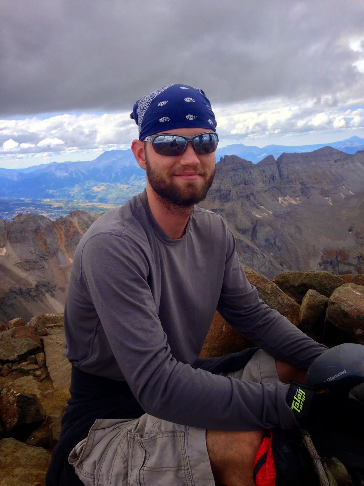
      I gritted my teeth and decided to push through to the top and take a long break there. When I finally made it, I was by myself, and what a sight it was. Surrounded by fourteeners and the beautiful Collegiate/Sawatch mountains, it was a sight worth seeing. I set down my pack, took Salix's off and took in the views while she wandered around. A few minutes later, a young man joined me, followed by two others (all individual climbers). They began to discuss how many fourteeners they had climbed (one said twelve which made me feel jealous as I had a measly four), and then began to take picture for each other. I asked one of them if they would take a picture of my dog and I with Belford in the background as proof, and he readily agreed. After everyone had taken the obligatory pictures and done what they needed to do, they stood around and started swapping stories. I, on the other hand, took out my sandwich and Salix's food, and we ate. I was exhausted from the early start, so I decided I would leave the summit at noon (twenty minutes from then). I put my headphones in, my sunglasses on, rested my head on my backpack, and started to snooze.
      At some point, I think one of them told me I should head down soon, but in my half sleep I didn't understand what he was saying. They left at some point during my nap. A smart thing as the clear blue skies were beginning to turn grey as clouds rolled in from the north. I paid no attention to them, however, as I was fast asleep and had checked to make sure there were no thunderstorms forecasted for that day. There was a loud rumble and the sun suddenly disappeared, startling me awake. The beautiful day I had fallen asleep to had become a windy, rainy, thunderstorm, and I was caught at the highest point in the area; a perfect lightening rod. I yelled at Salix to get up, and hurriedly put on our gear and began to run as fast as we could down the ridge.
      The clouds were getting darker and the rain was getting heavier just as we reached the lowest point in the saddle. On my way down I passed an older woman and her two young sons (probably in middle school and high school), saying that they were going to try and get Oxford in and run down the opposite side to avoid the storm. I told her I wouldn't risk it in the lightning, but she knew as much as I did about the area. I'm not sure what ever happened to that family, but if they were going down the slope I think they planned on doing, the weren't going to reach a trail anytime soon, and would be bushwalking form many miles and would easily become lost. Granted, I say this because they were obviously completely unprepared, with nothing but hoodies on and no packs, but they could have easily had more knowledge of the area than I did. I pray that that family made it down all right.
      Part way up the Belford saddle, I heard and felt a deep rumble and knew I had to make a choice: bushwhack down Belford Gulch or risk lightning. I chose to bushwhack, thinking that Belford Gulch drained into Missouri Gulch, almost like a T-shape. I expected to have to bush back through some trees and then hit the trail if I kept going straight. In other words, I thought that Missouri Gulch ran North-South and Belford Gulch ran East-West, and that the slopes I had seen earlier just as I came out above timberline were the slopes of Oxford, when in reality they were Peck's Peak. Long story short, I was going into a trap.
      I called Salix to me and pointed down the slope and we rock surfed down the first 1000 feet. At this point, I had two worries: One was the lightning and hail, and two was mountain lions. The latter may seem ridiculous to most readers, but I had already encountered one up in the Colorado Rockies when I was in 8th grade on a family vacation, and this terrain was exactly what they would be in. Moreover, I knew that mountain lions were beginning to prey on dogs, and Salix would be a prime target. The loud thunder and rain didn't help either, as anything that made a noise made me jump and look around for any wild animals.
      The mountain lion never materialized, however, and we made it to timberline without incident. Of course, at that moment the skies began to turn lighter again and the thunder moved on. However, we were stuck in the gulch and so we had to keep going downhill as I was almost out of energy. We moved into the forest, climbing through bushes and over fallen trees (and there were a ton due to rock slides/avalanches). Multiple times we crossed over rock slide debris, and so this became a worry too. After half an hour of slow going, we ran into a collapsed cabin and some old mining equipment and trash. At least I knew that others had been here before! And I hoped that this was a place that people would visit since there were historical sights, so I began to search for a trail. I soon found one and Salix and I followed it. It quickly became apparent, however, that this trail had fallen into disuse as we were constantly crossing rock slides, debris and fallen trees. It wasn't long before we lost the trail completely and I grew frustrated.
      I began to realize that I was lost and that it would take hours to get out at the pace we were going. I sat down and began to think of a way to get us out. In the silence, I heard running water and grinned. If there was water, then this would lead downhill, and it would inevitably drain into the stream in Missouri Gulch! Foregoing any hope of climbing Missouri Mountain, I focused all my attention on getting off this mountain and back to my truck.
      We must have been at 11,000 feet by this point as we followed the stream downhill. It was still incredibly hard work, climbing over trees and helping Salix through the bushes and such. We finally reached a clearing and I saw an abandoned cabin with a trail next to it and cheered. We had finally reached Missouri Gulch! This is the same half collapsed cabin I had seen earlier just as we reached timberline on the way up this morning! "Hello?!" I yelled, hoping for a return call.
      None came. This cabin had been camped in earlier by some backpackers, and so I had hoped they would still be nearby. I walked up to the cabin and realized that his was not the same cabin. It was just one of many that dotted these mountains. The cabin was in as good of shape as my emotions were. I was lost, tired, hungry, out of water, and had just had my hopes dashed again. Tears came to my eyes, and I quickly wiped them away. I knew that if I headed in a straight line, I would reach Missouri Gulch at some point.
      We kept pushing for two more hours, following the abandoned trail through debris. I soon realized why this trail had fallen into disrepair; it was extremely steep and the whole slope was prone to slide. At one point I grabbed a tree to stop myself from sliding down the slope, and it came free and walked Salix in the face. Keep in mind, this wasn't a small tree, it was a very large adult Aspen tree that came clean out of the ground, roots and all. I stopped and hugged Salix to let her know I was sorry, and checked to make sure she was alright. Once I determined she was fine we began moving again, carefully avoiding the trees as much as possible. I soon heard the roar of a large river ahead and realized we were not headed toward Missouri Gulch, but that we had somehow reached Clear Creek. Clear Creek was the river that passed Vicksburg (the ghost town I had parked at and the trailhead). This mean I was still East of my parking spot, but I was delighted to finally have a reference point.
      I followed the trail, anticipating that it would somehow connect to my original trailhead, but soon lost it. Frustrated I walked to the edge of the large river and saw my predicament. I could see the dirt road I had come in on, but between it and I was a very deep and strong river (one that I could not cross with Salix) and a cliff on the opposite side which I could not scale. I yelled in frustration and realized I had to keep going West. I started that way and was soon confronted by a very large cliff. As I made my way up it, already exhausted from the climb and bushwack, Salix began to wine behind me. I turned around and realized that should would not be able to make it over this. However, I realized that we had to keep going, so I picked her up and carried her a few steps at a time over the cliff. Once we reached the other side, I looked across the river to get a reference point.
      I could not see the road anymore, and began to worry we were already West of the trailhead, and just heading deeper into the mountains beyond the end of the road. In my desparation, I looked for some familiar scenery in the mountains above the road to, but saw none. I had driven up in the dark, so I never got a chance to see what the other side looked like. I had no reference point and was lost, in part, due to my frustration. If I had simply kept calm, I would have realized that Belford Gulch must exit East of the trailhead because of where it had drained out at, and thus I would inevitably hit the trail if I continued West. However, exhaustion and dehydration kept me from realizing this, and my frustration was compounded. I took out my phone in hopes that I would get enough signal for the GPS to locate me, but to no avail. I sat and wept a little, and Salix sat next to me offering her stoic support. I finally pulled myself together enough to start thinking again.
      If I didn't hurry, I would have to be finding my way around out here in the dark with no chance of running across any help. So I began to yell for help and continued West, over cliffs that were the roots of the mountain. Finally, I decided to take a look across the river in hopes of seeing a vehicle to indicate that the road was there. After a minute of waiting, I prayed silently to God, begging that He would give me a sign of some kind for help. Lo and behold, just as I was about to turn around I saw the unmistakable top of a car as it zoomed down the dirt road. Since I had no idea where I was and no idea where the road would end, I decided I had no choice but to cross the river and make it to the road.
      I took Salix next to me, put on her leash so that I could tug her along when the river became too deep for her to walk and we began to cross the powerful river. Thankfully, the river was only just above Salix's shoulders, so she did have to swim, but I was still tall enough to provide her with help to stay upstream. Using the technique I had learned in Outdoor Leadership class, I braced myself against the current by facing upstream with my feet wide apart and a stick as a third point for balance. We slowly made our way across the river and finally came out the other side. I collapsed in happiness, thankful that Salix had not gotten caught up in the current and to finally be on a road. We began to hike up the road, continuing in the same direction we had been doing earlier. A minute later, a jeep came rolling down the road, and I waved them down. I teared up in happiness, just thankful to see people again.
      "Hi there, I'm Daniel, I just climbed Oxford and Belford and I'm trying to find my way back to Vicksburg. Do you know which direction that is?" I asked. "Yes, it's about a mile up this road." The man replied, pointing in the direction we were headed. It was an elderly couple out on a four-wheeling trip, and they were obviously on their way back home. I thanked them and began to continue my hike. "Are you alright?" Asked the lady, looking concerned. "Yes ma'am. I'm just very tired. We got lost and had to bushwhack our way down here." I replied. She looked at her husband and then asked "would you like a ride back to you truck?"
      Normally I would say no, as I would not want to be a burden to anyone, especially as they were ready to get home. However, I was so exhausted and ready to get home myself that I gratefully said yes. The older man hopped out of the jeep along with his dog so that Salix and I could get in. He said that he would stay there while the woman dropped us off and then she would go back down the road. I was so grateful for her help that I almost wept with joy. We were back at the truck in just a few short minutes where I offered the woman some money, but she generously declined, saying that she was glad just to help. I don't remember their names, but I am very thankful for their kindness. Especially for going out of their way to help a random hiker. Because of what they did, I promised I would help any hiker/climber I came across from now on in the backcountry, even if I had to go out of my way.
      As I drove home, I called my wife and told her of our ordeal and that we would need food when we got home. Glad that these mountains were behind me, I was ready to take a short break before my next adventure. This hike opened my eyes, and I consider this one of the two climbs that turned me from a hiker into a climber. I realized that in order to get fourteeners in the summer, I would need to have a turnaround time of noon. I also needed to have a map, compass, and water filter (and later I would always carry the Ten Essentials in case of emergency). Finally, I needed to learn more about the mountain before I went, and that I should never leave the trail unless it's life or death. There is no such thing as a "shortcut" in the mountains. Trails are there for a reason; use them. Don't take a "shortcut" because it often makes things take longer.
      Although I was dead tired and in need of a break, Mount Antero was in my sights, and I would be there in just five short days. In the back of my mind, I was excited and rearing for more.