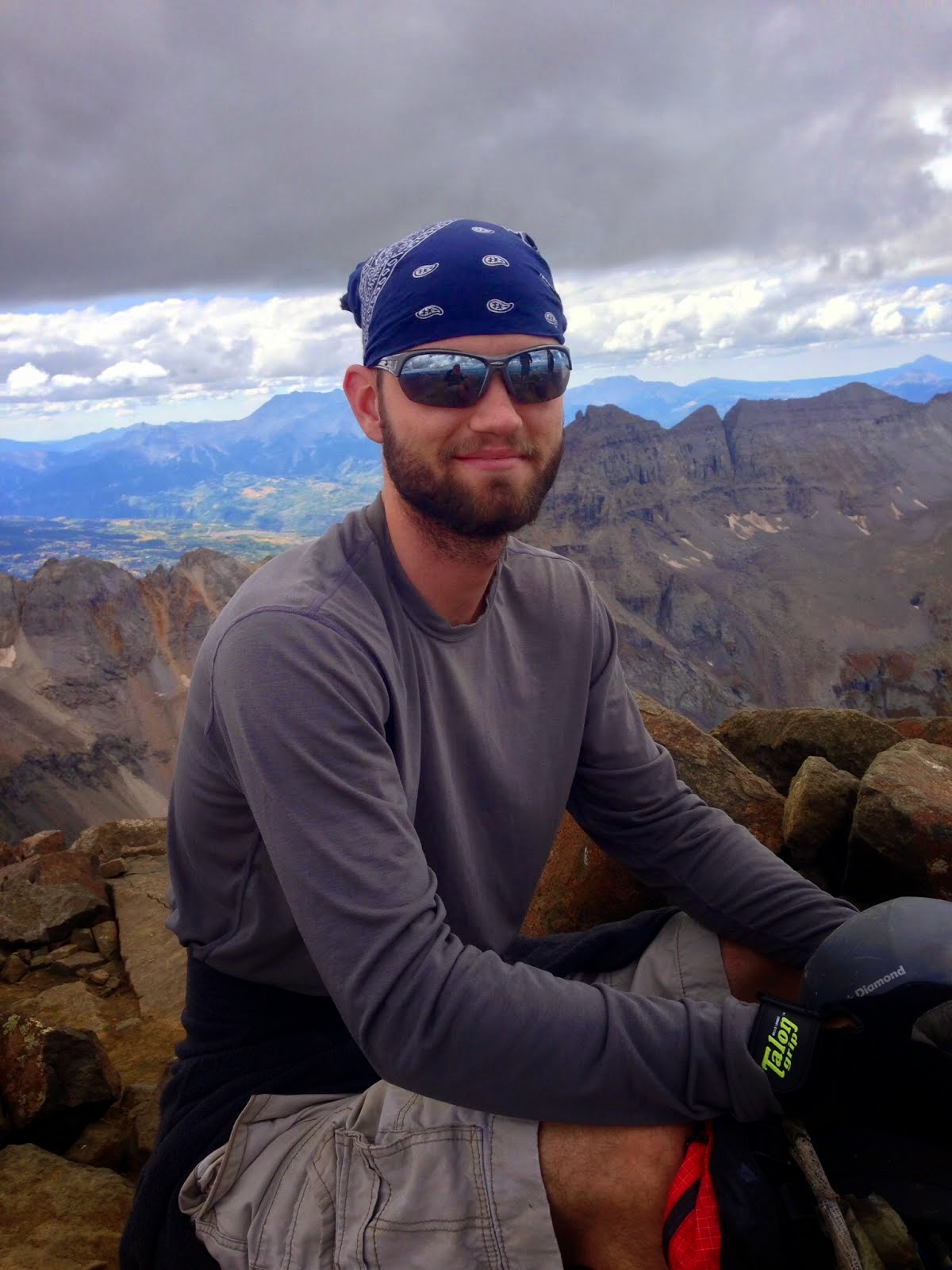
Mount Princeton
Date Climbed: 5/12/16
Climbing Partners: None
Elevation: 14,197
For more photos, follow me on Instagram or add me on Facebook:
drweiss2
Daniel Weiss
The rumble of the truck was comforting as I slowly wound my way up highway 287 to Buena Vista. It was around 2 AM and I had woken up just an hour ago. I still had two hours until I made it to the trailhead, but that at least gave me time to wake up. This is one of my favorite parts of the climb: the easy drive up, radio playing in the background and the steady hum of the engine that promised safety and warmth. In my rearview mirror, there was not the usual black void of a midnight drive, but a yellow blur. As Mount Princeton was my goal, I had brought along my four-wheeler in order to make quick and easy work of the road up to the radio towers.
Two hours later, I was at the winter trailhead, with a clear four wheel drive road ahead of me. I quickly hopped out of the truck, untied the four-wheeler and put down the ramp. I turned on the engine and the gas, pulled the clutch, pressed the start button and... nothing. Just a slow dead rattle as the engine sluggishly attempted to turn. It could have been the cold air, but having just charged it, it should have been able to start. I tried once more, praying it would start. Again, a dead battery. There were two options: start walking from here, which would double my mileage and make it nearly impossible to get down before the snow softened and avalanches became a real danger. The only other option would be to drive my huge truck up the extremely narrow road and risk getting stuck, or worse sliding off a cliff. I had turned back enough on Princeton and was not willing to concede defeat yet. So as the sun rose, I began the slow, rocky drive up the narrow Mount Princeton Road.
I was much more worried about this road than the hike ahead. Should I make it to the radio towers, I would have a relatively quick and straightforward climb. The problem was there was no way of knowing how far down the snowline was. Should I run into impassable snow too far down, there would be no place wide enough for me to turn around. And a road this narrow and steep would be near impossible to back down (especially with an ATV blocking my rearview mirror). Slowly the miles passed by. An hour (and some very sketchy turns) later, I ran into some deep snow. Unwilling to risk getting stuck, I found the nearest switchback and managed just to find enough room to turn around and park. It couldn't be much of a walk to the radio towers, and that was good enough for me.
I was already more than an hour behind and I would fall even further behind because of the snow, but with a good forecast, I knew I had time to give. I began the long hike and within half an hour had reached the radio towers. another 40 minutes and I was at the end of the road and beginning the treacherous hike across the Princeton Trail. Normally, this hike would be quick and (14er-wise) easy. With snow, as I have said before, there was no such thing as easy. With a winter like snowpack and rapidly warming temperatures already, I decided to play it safe and leave the trail, hiking up and down multiple hundreds of feet around avalanche chutes. The work was exhausting and the progress slow, but I refused to quit with such good weather.
Thankfully, I had been training and working out in order to prepare for the upcoming spring climbing season, and the extra energy helped. Unfortunately, even though I was able to make progress across the first few chutes, I had two giant (and filled) avalanche chutes between myself and the ridge connecting Tiger Peak and Mount Princeton. I could either cut straight across them, risking a huge avalanche, or go up and over (as I had the others) which would add a lot of time and increase the danger on the way down. I decided to play it safe and go up and over again, but this truly slowed me down. By the time I was on my way over the last major avalanche chute, it had been over an hour and I had only made a few hundred feet of progress.
By now I was on the ridge and had a straight shot at the summit. Unfortunately the snow was just soft enough for me to sink in a few inches, creating slow progress on what should have gone by quickly. Already exhausted, I was at the decision point. Should I turn back, knowing that the snow would grow softer and more dangerous every minute I delayed? Or should I continue and conquer the summit I had already suffered for? I decided to just put my head down and push through. Step by step, breath by breath, I made my way across the rugged ridge, occasionally passing by cornices the size of buses, forcing me to stay back many feet from the edge which looked so invitingly smooth and easy to travel across.
Soon I was looking up the long steep slope which led directly to the summit. I could see evidence of avalanches directly across the faint trail I could pick out. Thankfully, the snow at this elevation was still frozen solid, and the danger of any avalanche was relatively low. I took a deep breath, put my head down, and decided to go straight up the slope, ignoring the trail altogether. Step, breath, step, breath, step, breath. It was hard work, but the time spent on Insanity (a DVD workout system) seemed to be paying off. Once I had a rhythm, I simply ignored the desire to stop and take a break and pushed. After 20 minutes of solid front pointing straight up the slope, I noticed the angle give way and a cold blast of wind forced me to look up. A little off to my right was the summit, and below me were thousands of feet of snow and rock. A new energy seemed to flow through me and I quickly skipped (more like stumbled) up to the summit, heart pumping. The exhilarating feeling of accomplishment washed over me and I fell onto my back, breathing heavily and sucking in all the water I could get. It was so peaceful. Not a soul for miles around. It was blue bird days like this that I lived for. Where I could sit on a summit and reflect on the beauty that God has made for us. Even the harshness of winter had its own beauty, which I throughly enjoyed and even preferred on most summits. But it was nice to still have the feeling in my toes when standing on a summit for once.
After a few pictures and a quick lunch, it was time to continue down. I refilled my water bottle with a spare liter I had and began the slippery walk down. In order to save time, I decided to glissade down. Just as I sat, I felt my water bottle slide out of its pocket and quickly roll down the slope. I lunged for it, but the snow was too solid and the bottle gained speed and was out of reach long before I could reach it. I watched it slide thousands of feet, traveling faster and faster as it made its way down to the basin far below. I was speechless. All of my water had just tumbled down the mountain and I still had the most dangerous, hardest, and hottest part of the climb ahead. I stood up and decided to hike down instead considering my last blunder. Thankfully, the ridge went much faster as I was able to follow my footsteps back down. Once across the ridge, I was faced once more with a major decision. I could go over Tiger Peak, which would allow me to get a 13er in, and which would be much safer, but much more difficult, especially without water. The other option was to risk the avalanche chutes once again, now with much warmer temperatures.
I decided that the best course of action was to run the risk of avalanches rather than dehydration (and extremely hard work). Because I had used so much energy getting up, I had almost none left to work up and down the chutes again and decided to cut straight across the steep slopes following the summer trail. At first, the snow was in great shape and the risk of avalanche was small. But as I made my way down, the snow grew softer and softer under the intense sun. Half way across, I was committed and I was sinking past my boots (a sign of wet slab avalanches). Knowing my life was at risk I moved as fast as my weary legs would carry me across the last two dangerously steep slopes, sinking up to my knees at times, praying for protection. Thankfully, nothing eventful happened and I was standing on the road, looking back at Princeton.
The climb was in the bag, and all that was left was a difficult drive back down the narrow road (but at least that didn't involve walking). Unfortunately, the sun had done its job and the "easy" hike back down the snow filled road was an exhausting slog which took much longer than it had on the way up. Every step was either so slick I fell or so soft that I sunk up to my waste. A section that had taken only ten minutes earlier in the morning now took half an hour. After another hour of painful potholing, the road dried out and I was able to walk on dirt and mud. The rest of the hike was downhill and the truck soon came into view, and not a moment too soon! I threw my backpack into the back and gratefully gulped down the gallon of water I had saved for my return. I felt dizzy and weak from so much exertion and so little water. Dehydration had set in, and I had made the right decision avoiding the climb over Tiger. The narrow road was slow going but uneventful. I eventually made it back to the highway and set the truck on cruise control. Another 14er down, and a season of snow climbs ahead.
Although my desire to summit the 14ers had diminished, my desire to find technically challenging peaks was very much alive. As so many mountaineers before me had experienced, with every 14er I conquered, I wanted a bigger and more technical challenge. As Aconcagua loomed closer, climbs like "Super Star" and "Dragon Tail" appealed more and more. 14ers are amazing and beautiful climbs, and character building. Great for a big mountain experience right in your backyard. But they are not very remote compared with the peaks of South America, Alaska, and the Himalaya. I can only hope that God will continue to open doors that will allow me to lead an expedition to South America and the famous Aconcagua.
Mt. Elbert
Date Climbed: 11/12/15
Climbing Partners: None
Elevation: 14,433
For more photos, follow me on Instagram or add me on Facebook:
drweiss2
Daniel Weiss
Second winter climb of the season. Although the snows stayed late last year, and summer did not seem to last long enough, I was ready and rearing for some snow climbing and skiing. It seemed as though nature wanted to reconcile the late snow last season, and thus the warmer temperatures than usual lately have led to more rain than snow so far. Although precipitation has been above average, the warmer temperatures have prevented significant snowfall until this moment. Just two days prior to my climb, a massive snowstorm blew through, adding over a foot of snow and changing the avalanche danger to moderate.
Having failed to climb Yale two weeks before this climb, I was determined to make up for it and summit Yale. With the new snowfall, however, I was forced to take a more stable route, and thus decided upon Mount Elbert. This way I could shorten up the hike and elevation gain, as well as knock off the Colorado high point off my bucket list all at once. So with a 4 AM alarm and a new jacket to test out, I set off into the heart of Colorado.
The sun rose just as I hit the trailhead. Unfortunately, my lack of 4-wheel drive and a low snowline forced me to walk up the 4WD rode, and so added a few miles to my journey. The road went by quickly and soon I had to put on my microspikes. Connecting with the Colorado Trail, I made a quick half mile hike over to the South Elbert intersection and began the steep trudge up the slope, which the Swatch range is so famous for.
The trail was easy to follow at first, as someone in snowshoes had obviously broken trail shortly after the storm. Not having snowshoes myself, I was worried that I had come underprepared (a mistake I often remedy by over-preparing). Although the snow coverage was no more than 4", I was sure that the snow above timberline would be a tough challenge. As the miles and elevation went by, the views became more and more spectacular. The dense forest was slowly replaced by open sky and a vast valley. Ahead lay rugged snow-capped peaks and (to my trepidation) enormous snow plumes, indicating a high winds and low temperatures. Just hours before my truck's thermometer had read -3 degrees. Although it was bright and sunny, the forecast called for temperatures reaching -22 degrees at the summit. Knowing this would be common come midwinter, I had made some purchases during the summer to deal with these extremes.
Among them were gloves designed for Alaskan peaks and a belay jacket designed for comfort somewhere in the -10 range. I even wore three layers of pants, which I only did when the forecast called for blizzard conditions. Thus, i was prepared for the worst it could throw at me.
As treelike came closer and closer, the wind began to pick up, and I knew that the cold would not be my only enemy. Just over a year before, I had battled 60+ mph winds on Democrat and the surrounding 14ers. The winds not only chilled me to the bone, but had forced me to slow down and even lay down when the gusts became too strong. If I had to do the same on Elbert in knee deep snow, I would be lucky to summit before dark, and there would be no backup on this trip. My only consolation was that I would have cell phone service almost every step of the way, so that I could call for help in an emergency.
By 9 AM I had reached timberline and decided to layer up and eat in preparation for the battle with the wind ahead. If it was as bad as it looked, I would not be able to sit down and enjoy lunch as I had planned, but would have to make a mad dash to the summit and back in a hope of reaching treeline before nightfall. What's more, the snow had steadily grown deeper and deeper. So much so, that the previous hiker had obviously given up a mile back, forcing me to blaze my own trail to the top. Although it may sound as though I had plenty of time until dark, it will become very clear just how slow one moves above timberline when winter comes. Just to give you an idea of just how tough it is, on a typical winter hike, expect it to take three times longer to reach a destination than in the summer in non-technical terrain. Although progress had been great (averaging 2 mph up to this point), things were about to screech to a halt.
As I set out from my shelter of trees full of a delicious Twix and water breakfast, a snow tornado came roaring down the slope. I turned away just in time protect most of my face from the stinging cold of the snow. Imagine, for a second, videos of Mount Everest where the snow is blown for miles from it's enormous summit. The sound of the steady roar of the jetstream and the majestic waves blown from it's pyramid. I had a very similar sight as I left the trees and the southeast bowl was laid bare before me, with just the smallest view of the summit miles away. Granted, Elbert is not nearly as intimidating, and the winds are much more tame, and the temperatures much warmer, but the beauty and challenge is still there.
Up I went, making good progress at first until I came to the first wind-loaded slope that led to the first false summit. Soon I was huffing and puffing my way up a small slope, making on step every breath or two, sinking in to my knees. If the rest of the ridge was like this, I wouldn't make the summit until nightfall if I was lucky. But since the weather was supposed to be good and there were very few objective dangers on Elbert, I was determined to make the summit, no matter how long it took. After half an hour, I had only made a few hundred feet of progress. I pulled out my ice axe for balance and began to push harder, hoping that the high winds had exposed the rock on the windward side of the ridge.
As I approached the top of this "small bump" on the ridge, I finally reached an island of rocks, allowing me to make quick progress over the hill. Although the summit seemed no nearer, I saw my saving grace: exposed rock on the north (right) side of the ridge. I counted 4 more false summits, put my head down and moved on. Every time I would reach the top of a false summit, I would set my sites on the next and remind myself that I only had a handful more. The second one went by quickly, and the wind began to diminish. The sun appeared to be chasing away the winds, and I could no longer see the long spindrift I had seen on my approach.
On the third false summit, I could see the faint outline of the summer trail switchbacking its way up the steep slope. This would be the real test. If I could make it to the top of this, all I had left was the summit slope. But this would also be the longest and steepest part of the hike. Although the trail was very easy to follow and I flew up the first half, the trail soon disappeared and as the slope began to level out, the snow became deeper and deeper. Whereas the snow was no more than a few inches deep on the lower half, I was now forced to find the path of least resistance and pray that the snow was supportive... which was not often the case. As I ran out of steam, I looked back over the ridge and the valley below me. Off in the distance was the small town of Leadville, Colorado's highest city. To my right was the gigantic southwest bowl and a frozen lake, and to the left were the treacherous Box Couloirs of Elbert. Directly below me was one particularly steep shoot, which I hoped would slide so that I could see a live avalanche. Sure I had read about and watched videos of avalanches, but I had never seen one in person, and hoped that the warm temperatures and heavy snowfall would release one just to add some excitement to the journey.
Surprisingly, the temperatures were much warmer than predicted (although they were still well below freezing), and I was forced to shed my jacket. After a few more minutes of wading through the snow, I leaned into the slope and sat down. I needed water and some food for energy. Taking in the beautiful scenery before me, I pulled on my jacket again and felt thankful that I did not have to race to the top as I would during the summer. No thunder in winter! Suddenly I saw movement in my peripheral view, and turned to stare directly at it. A tiny black dot was making quick progress up my trail. I was not alone. I had enjoyed the solitude earlier that morning, but was relieved to know that someone else would be nearby to help if I were to twist an ankle or something. Being so close to the summit, I took a longer break than needed, waiting for my companion to join me and hoping that he or she would be just as glad to share the days first summit together.
After a while of waiting, I decided that this person was moving so quickly that I would be better off just breaking trail most of the way as they were obviously moving faster than I. just as I made the push to the 4th and last false summit, my heart sank. Away in the distance ahead and a little higher, there seemed to be even more false summits. I had already been at it for 5 hours and still had to get down. But it would be a waste to stop this close, and so on I went. The route-finding was awful and progress was slow, but the summit came steadily closer and closer. Just a few hundred feet of the top, my companion caught up with me. Looking back, we made eye contact and nodded to each other. We were both exhausted and agreed that we could talk on the summit if there was any shelter to be found.
I dawned an extra jacket, gloves, and my baclava anticipating a blast of icy wind upon summiting. Lo and behold, my efforts were not in vain. As my partner broke trail the rest of the way, I came up close behind and was greeted 1) with a spectacular view of the Swatch and Aspen ranges and 2) a blast of arctic wind that instantly froze any water that was exposed. My nose instantly began to run and then froze, and my water bottle quickly turned into a chunk of ice frozen shut. We made unbalanced progress the last dozen steps to the top and made our congratulations. My eyes watered from the cold and I quickly regretted not equipping my ski goggles before the summit. I took some quick pictures and a shot of myself on the summit as evidence, and asked my friend where he was from.
I instantly realized why he had caught up so quickly. Not only was he from Leadville (living at twice the altitude of Denver), but he was quite obviously a trail runner. Fast and light is a trail runners motto, and I could tell he was freezing in the icy wind, with nothing but a shell jacket and thermal pants on over breathable shoes. Good thing is he could make it up pretty quickly. Bad thing is if something went wrong and he was forced to spend any amount of time in the dark, there would be no chance of his making it through the night. It is the polar opposite to the style of climbing I do; slow and steady. Safety and preparation for every scenario. After a quick exchange, we began the descent. Not wanting to blow out a knee or ankle, I did not event try to keep up. I was already losing feeling in some of the toes on my right foot, and had no intention of spending a night out because I rushed and hurt myself. Far below we could see another hiker making slow progress up the slope.
Half an hour later, a miserable looking young man carrying an unnecessarily large pack stood before me. It had taken him 6 hours just to reach this point, and he still had another hour to go (if not more). It was already close to 2 PM and the sun would set at 4:30. This meant he would be lucky to make it back to timberline by 4:30. Although it was warm right now, the minute the sun disappeared, the temperatures would drop rapidly and things would get dangerously cold. He told me he had come from San Diego just yesterday. I asked how he felt. Dizzy and exhausted; classic Mountain Sickness, which can have life threatening consequences. Although we were not really that high, the altitude difference and energy required to move at this elevation could cause over-exertion and could cause and edema. That being said, he did not appear to be in that bad of condition, and was probably just tired. He asked how much longer, and did not appear happy with my response. He then asked if I thought he should go on. I explained that the only thing stopping him was his condition. The weather would be good, even after dark and asked him if he had plenty of water, food, and a light. Yes to all three, so I wished him luck and told him just to carefully follow our trail on the way back down. He decided to continue up and we went our separate ways. Going down went much quicker than going up, although my knees were throbbing when I finally made it to the upper trailhead. A quick dash back down the road and I was in my tuck and on my way home.
Another 14er down and still a lot to go. But I felt confident that I could handle whatever they could dish out and a 4th class 14er with snow wasn't sounding too crazy after all. Elbert was nothing more than a long walk. It was the technical demands of climbs like Wetterhorn and Dead Dog that peaked my interest now. For a real mountain, a high camp, some technical axes and crampons, a rope, and luck would be all I needed for success. So what was next? Sangre De Cristos and their infamous Crestones or a long committing journey to the deadly Elk Range, with no safe climbs but all the adventure a mountaineer could want.
La Plata Peak
Date Climbed: 6/24/15
Climbing Partner: Nicole
Elevation: 14,336
For more photos, follow me on Instagram or add me on Facebook:
drweiss2
Daniel Weiss
Running off of an hour and a half of sleep in the last 30 hours or so, plus a 3 AM wake up time and a 14er just two days before, I knew this was going to be a hard day. Luckily, I didn't have to do this climb alone. Just the day before, a friend of mine, Nicole, asked if I was interested in climbing a 14er. The answer is almost always yes. So we set our sites on Huron Peak and planned to meet at her house at 3 AM. I pulled up to my her house just a few minutes late, half asleep and wanting nothing more than to just go back to bed.
We quickly packed up and began our two and a half hour drive. Nicole agreed to drive for the first bit of the drive while I slept (I was being a true gentleman as you can tell). About an hour into the drive, we began to discuss our plan. There were some concerns about a flooded river we would have to cross on the drive up, so we decided to have a backup plan if it looked too deep. La Plata and Mount Sherman were our two options. There was a problem, however. Because of the forecasted thunderstorms in the afternoon, we would only have one shot at picking the right 14er. My experience on Bierdstadt just a few weeks earlier had taught me to be very conservative when dealing with lightening. Thus, we would have to arrive at the trailhead as soon as possible in order to summit well before the predicted storms. So we discussed our options. On the one hand, if we chose Huron and the river was too high, we wouldn't have enough time to get over to La Plata's standard route, and so we would have to settle for Sherman on the way home as it was a much shorter hike. Yet, Sherman didn't excite us as it wasn't as spectacularly beautiful as Huron. However, if we went for La Plata's standard route, we might not have enough time to summit as it was 3 miles longer than Huron's route.
Since I've had my share of failed attempts, I didn't want to waste all the energy just to get within a few hundred feet and turn around. So I voted for the conservative decision in order to guarantee a 14er summit. Nicole said we should just go for La Plata as it was a beautiful climb and we still had a shot of summiting because we were early and could keep a good pace. I decided to see if there was an alternative and checked out 14ers.com to see if there was a compromise. Surprisingly, there was! La Plata had a Southwestern ridge that could be climbed and it was shorter than the standard route and had less elevation gain. We decided to attempt Huron and go to La Plata if we couldn't make he trailhead.
At around 6, we pulled up to Winfield (an old ghost town) and took the fork in the road that led to Huron's trailhead. Shortly after we began up the rough 4-wheel drive road and our progress slowed. About a mile up the road we saw what we thought was the creek crossing that had stopped so many cars. However, it was little more than a trickle and we easily made it across. Excited, thinking we were going to have the opportunity to climb Huron, we moved on. However, just as we came around a corner, we noticed a large truck pulled off to one side. It was odd as the road had not grown any rougher and it was still a good distance to the trailhead. Just then I noticed something blocking the road: a fallen tree. We stopped and I walked up to it and attempted to move it, but there was no way. It was a very large tree and we had no chainsaw to move it with. So I got back in the car and we quickly retreated back down the road, hoping to get to La Plata's trailhead soon as we were now very late.
Arriving at the washed out road around 7, we quickly put on our gear and began our hike. In order to cross the river that now flowed across the washed out road, we had to balance on a few trees that had been set next to each other across the gap. Not trusting the makeshift bridge, Nicole crawled across on all fours and I had a great time laughing at her slow progress. Karma quickly caught up with me, though, as I had to stop a few times to retie my brand new boots because of some excruciating blisters I had received from my climb of Mount Lincoln. Finally, we were on our way and made good time to timberline.
Once there, we saw one of the most beautiful vistas I had ever been to. On all sides of the gulch we steep mountains, covered in wildflowers. Off in the distance were the taller peaks, summits just barely layered with snow. Off to the southwest were the famed "Three Apostles" and their stunning views. To the Southeast was Huron Peak. To the Northwest was the tip of Sayers, and to the northeast were some stunning cliffs with some interesting looking snow climbs. We continued up the gulch and marched through the muddy willows. Thankfully, the progress was much faster than it would have been with snow on the ground, so I had no issues with the mud. after half an hour of trudging through the mud, we reached the base of a very steep colouir. It took us about 45 minutes or so to reach the top of this, and the sight that greeted us at the top stopped my heart.
Immediately to my left (west) was a knife edge with thousands of feet on either side that lead to a very small peak. To the right (east) was a smaller looking gentler mountain slope. When Nicole reached the top, I pointed at the peak to our left and she laughed (sarcastically). It was hopeless. We had no gear with us that could deal with the kind of challenges we would have to face if we attempted the peak. I need to explain that this trail is not well marked as it is not used very often. It took us half an hour just to find the trailhead. My map also cut off about half of the trail, so I had nothing to refer to. The only way we knew we were headed the right direction was by the faint trail. However, the trail ended at the top of the color and we had no idea which mountain was the right one. Based upon my impressions of La Plata, I thought La Plata had a western ridge that looked much like the mountain to the west of us. However, the one time I read the route description for this trail, it had said it was nothing more than a class two hike and that there was a gentle slope after the willows. The hike before us was a class four hike (meaning scrambling and some technical rock climbing moves). I just assumed the website was wrong on the difficulty of the hike, just as it had been with Mount Evans.
The mountain to the east fit the description, but the location of the mountain to our west fit the location better. What's more, there was a trail we could see back down in the valley that seemed to be a route that would lead to the top of the peak. It also looked much taller than the other mountain. We both groaned; we had taken the wrong trail and it would take at least an hour and a half to get to the top of the other trail. Since I saw what I thought was Huron, and it looked like the mountain to our left was the only one west of Huron (just like La Plata is) I assumed the difficult mountain was La Plata. We began moving across the ridge, intending to go as far as we could. After some very slow progress I stopped and tried to assess our situation. Even if we could make the top, we wouldn't be able to get down fast enough to avoid the thunderstorms at noon. It would also be very risky to attempt this peak which had so much snow at the top mixed with steep rock. This climb required an ice axe and crampons. I only had an ice axe and boots. Nicole had neither, and I had no rope to belay her up the rock hard snow that would certainly be at the top. Our only shot would be for me to chop steps into the snow and hope that would be good enough to make it up the steep slopes once we made it across the ridge. However, the ridge itself was difficult enough since there were sections where we would have to down climb and the climb back up a hundred feet or so of 5.9+ rock (a very difficult climb even with rope).
I knew there was no way if we went straight across, so I looked back toward the other trail. We could traverse along the edge of the slope of the mountain and eventually meet up with the trail, but even that would be very difficult because of how steep the angle was. I turned to Nicole and asked what she thought. Neither of us were interested in a 13er (which is what we thought the peak to the east was), but neither of us wanted to go back empty handed. Since we were uncertain about which peak was La Plata, we decided to just try and climb the mountain to our east and hope it was La Plata. We back tracked and began our now hurried ascent. Just as I began to lose hope that this peak was La Plata, I saw two small figures coming down the slope. I yelled back to Nicole, excited that we could ask someone if we were going the right way.
It took much longer to reach them than I thought it would, but eventually we met up. I asked if we were headed the right way to La Plata and they responded with a yes. I felt reenergized and almost shouted for joy now that we still had hope. They told us that the clouds from the top were starting to look threatening and that we probably wouldn't reach the top before the storms came. I was disappointed to hear this, but I wasn't ready to give up yet. We thanked them and redoubled our efforts to reach the top. We had a lot of time to make up for, but at least the summit was now in sight. Although the slope looked like a very gentle one from a distance, it turned out to be much steeper and rockier than it looked, and it took an hour of tough going to reach the summit. However, just as I came of the lip of the mountain, ready to yell in victory, I was stopped short.
About a half mile in the distance and another 700 feet up I saw the true summit. We were already as high as the first peak we'd attempted and this next peak was much higher. It was undoubtedly a fourteener as it dominated the skyline and I could see people standing on it's summit. It just reminded my just how tall these 14ers really are. You always think you're almost there, but then there's always that last half mile or thousand feet left above you when you see the true summit. There were two more false summits standing between me and the peak. We had come too far to turn around now, and my resolve hardened to finish now matter what. I waited a little for Nicole to join me on the false summit and I could tell that she too was disappointed at the sight (beautiful though it was).
We began the long walk onward, willing one foot in front of the other. I began to think in small increments, just setting small goals for myself. I focused on just one small false summit and then the two big ones, telling myself it was just this one more false summit and then I'd be there. finally we met up with the standard route and in no time we made the short hike from the last false summit over to the true summit. I stood there, looking out over the magnificent view of the Sawatch Range. To the West I could just make out the famed Maroon Bells and to the North were the true giants: Massive and Elbert. Nicole soon joined me and we celebrated with high five and congratulations. I knew we couldn't really celebrate yet, however, as the threat of storms were all around us. None had appeared yet, but that could change in a moments notice with the clouds to both the South and East. Nicole had a quick bite to eat, and even offered me a bite of her sandwich as I had forgotten mine. This is one of the things I love about 14ers. One of my former teachers describes it in this way; "it creates a temporary community. It creates a small group where people can simply be themselves without the pressure of everyday life." It allows us to be more open and creates greater friendships through the struggles a team has to overcome.
After a quick chat with the other groups on the summit, we began the long hike back. I knew it was going to be just as long coming down as it was going up because of how steep and rocky the slopes were. The later it got, the more threatening the clouds looked and I began to have flashbacks to the storm on Bierstadt. When we made it back to the bottom of the saddle between the jagged peak (which I later learned was called Sayers) and the first false summit, we ran into a group of two men and three kids. They seemed to be going very slow and they had another hard two hours ahead of them. The man asked some info on the route ahead. I described the route but warned him that the storms were on their way. He encouraged his group to go faster, hoping to push them to the summit. I wanted to tell him to turn his group around since he had kids, but I knew it was up to his judgement. Shortly after consulting the other adult they decided to turn around. One of the children began to cry. I felt very bad since I had been somewhat negative in my assessment of their chances, but I had to be as it was not easy and they were already very slow and it was too close of a call to continue on with kids. However, the ultimate decision was theirs and they made the right choice I think. They began their descent and we moved on ahead of them.
After a long grind down to the bottom of the colouir we took a break to rest our knees and get some water. We were somewhat safer in the gulch protected by the steep cliffs and with timberline so close at hand. With this in mind, and the fact that I wanted to wait to make sure the group with the kids got down safe, I dropped my pack and sat next to a rock and took in the views. Nicole sat down as well and we discussed our trip so far and other 14ers we wanted to do. It was nice to finally be able to sit down and relax on a hike rather than face the harsh winter conditions and hazards I had dealt with so much in my recent climbs. Whiteouts, avalanches, frostbite, severe wind, and lightening turned these mountains from strenuous hikes into mountaineering feats. But the true joy from climbing a 14er was from hikes like this: an nice pace with no real obstacles and some time to enjoy the scenery.
I was half tempted to take a nap when a low rumble made me stand upright in an instant. I grabbed my pack and told Nicole we had to get down fast. I was afraid I had made the same mistake I had last time: we were too high for too long. We wouldn't get down fast enough, and as drops of rain began to fall, the lightening would be on top of us in five minutes. I rushed ahead, ripping through bogs and willows without even noticing them. I could feel the rush of adrenaline as I began to have flashbacks of Bierstadt. It was almost as though I could feel the static building up on my body again and hear the scratching on my backpack from the lightening strikes. But there was no lightening. Thankfully, we did not have the same experience as I had on Bierstadt, but we had made it back to treeline just in time. Once we were below the trees, I felt more relieved and we continued back to the car without incident. We congratulated each other and began to talk about other 14ers we wanted to do. Nicole had done very well as she hadn't done a 14er since last season. She was almost beating me up the mountain several times!
Overall, this is one of my favorite hikes and probably the best way to hike La Plata.One day I hope to go back and backpack into that gulch and maybe even take a picture from Crystal Lake. Not only had I gotten in a CCU 14er (one of the 14ers the CCU dorms are named after), but I had accomplished 14 peaks and had done one of the classic 14ers. Ahead of me was the famed climb "Dead Dog Colouir" up Torrey's Peak. I had no idea what it would be like, but I knew it would take everything I had learned from other snow climbs to reach that summit.